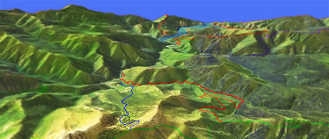
Cook and Green Tr959
Twitter Search
#cookgreentrail

Overall: 6
Aerobic: 6
Technical: 6
Steepness: 6
Flow: 5
Singletrack: 100%
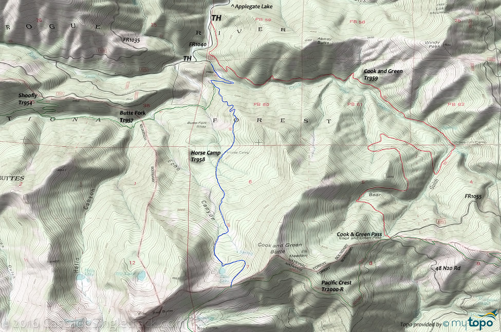
The Applegate Lake Oregon Cook and Green Trail is a lightly used trail near the Red Buttes Wilderness area, suitable for a strenuous OAB, or shuttle with FR1055.
Type
OAB
Length
Avg: 14mi
Ascent
Moderate
Elevation Change
TH:2350'
Avg Ascent:4700'
Ascent Incline
12%
Duration
Avg: 4hr
Weather
Forecast
NOAA
popup
USFS
As this trail is lightly used, be sure to check with the Ranger Station for current conditions. The trail is sometimes used by downhill shuttles, so be aware of oncoming traffic. The high elevation terrain will retain snowpack through late Spring.
Horse Camp Tr958 is open to biking but too steep for most to climb and the only upper TH access is by Pacific Crest Tr2000-R (biking prohibited).
Contact Rogue Valley MTB Assn if interested in helping with trail maintenance or other activities and information.
The name Cook and Green is derived from Robert Cook and two Green brothers who were partners in several mining ventures in this vicinity during the 1870s and 1880s.
From FR1040 the ride gently ascends a dense mixed forest comprised of canyon live oak, mountain mahogany and big leaf maple, with a 3.5mi traverse beside Cook and Green Creek before reaching the No-See-Em camp, followed by a gradual ascent along the west side of Bear Gulch.
The upper elevations pass through old growth Douglas fir forest, with ponderosa pine, noble fir, and the rare Brewers spruce. A small spring is passed just prior to reaching Cook and Green Pass, marking the end of Cook and Green Trail.
Hike option: From Cook and Green Pass, head southwest on the Pacific Crest National Scenic Trail (don't ride this trail. FR1055 parallels PCT so use it to get to Horse Camp Tr958) for 2mi to the junction with Horse Camp Tr958 above Echo lake. Turn right and descend Horse Camp Tr958 for 3.9mi.
Red Buttes Wilderness Hiking
The Cook and Green Area Topo Map contains most of the Red Buttes Wilderness trails. This map covers the area south, to the Klamath river.
The Red Buttes Wilderness area straddles the crest of the Siskiyou Mountains, with twin summits of Red Buttes anchoring the California border.
Reddish peridotite rock supports unusual plant habitat. Rocky buttes, forested ridges, and small glacial-carved lake basins characterize this rugged terrain, with a dense jumble of manzanita, snowbrush, and other brushy plants carpeting the dry south-facing slopes.
Summers are typically dry, from July to September, so carry water.
Directions: NW Forest Pass required right at the TH. Upper Applegate Road south for 13mi to Carberry Cr Rd, then go left and continue 1.5mi to the FR1040/FR1050 intersection. Go right onto FR1040 and continue for 3.5mi to the Cook and Green TH. View Larger Map. No Map?.

OAB Directions
cookin
- TH: Ascend or hike-a-bike for the first 2mi, then cross a creek and continue over more moderate terrain, with a shale terrain transitioning to moderate root covered surface.
- 3.7mi: Pass the No-See-Um camp, then cross Cook and Green creek and ascend the Bear Gulch creek draininge.
- 4.2mi: Cross Bear Gulch creek and switchback traverse the forested and open field hillside to the 6.6mi Bear Gulch creek crossing.
- 7.2mi: Cross another Bear Gulch creen tributary and reach the Cook and Green Pass, then enjoy the downhill back to the TH.
Trail Index
This Ride
Cook and Green Trail 959, Horse Camp Trail 958
Area
Red Buttes Wilderness
Azalea Lake/Fir Glade Tr955, Boundary Nat Rec Tr5254, Butte Fork Tr957, Darkey Creek Trail 5251, Fort Goff Tr5250, Frog Pond/Cameron Meadows Tr953, Middle Fork National Recreation Tr950, Pacific Crest Tr2000-R, Portuguese Creek Tr5252, Shoofly Tr954, West Fork Seiad Creek Tr5246
Campgrounds
Carberry Campground, Flumet Flat Campground, French Gulch Campground, Harr Point Campground, Hart-Tish Campground, Jackson Campground, Latgawa Cove Campground, Seattle Bar Campground, Squaw Lakes Campground, Tipsu Tyee Campground, Watkins Campground
Trail Rankings
Ranking consistently applied to all of the listed trails.
- Overall Rating: Ride quality and challenge
- Aerobic: Ascent challenge
- Technical Difficulty: Terrain challenge
- Steepness: Average incline
- Flow: Uninterrupted riding
- Elevation Change: Total elevation gain
- Ride Difficulty: Terrain challenge


