Twitter Search
#PacificCrestTrail
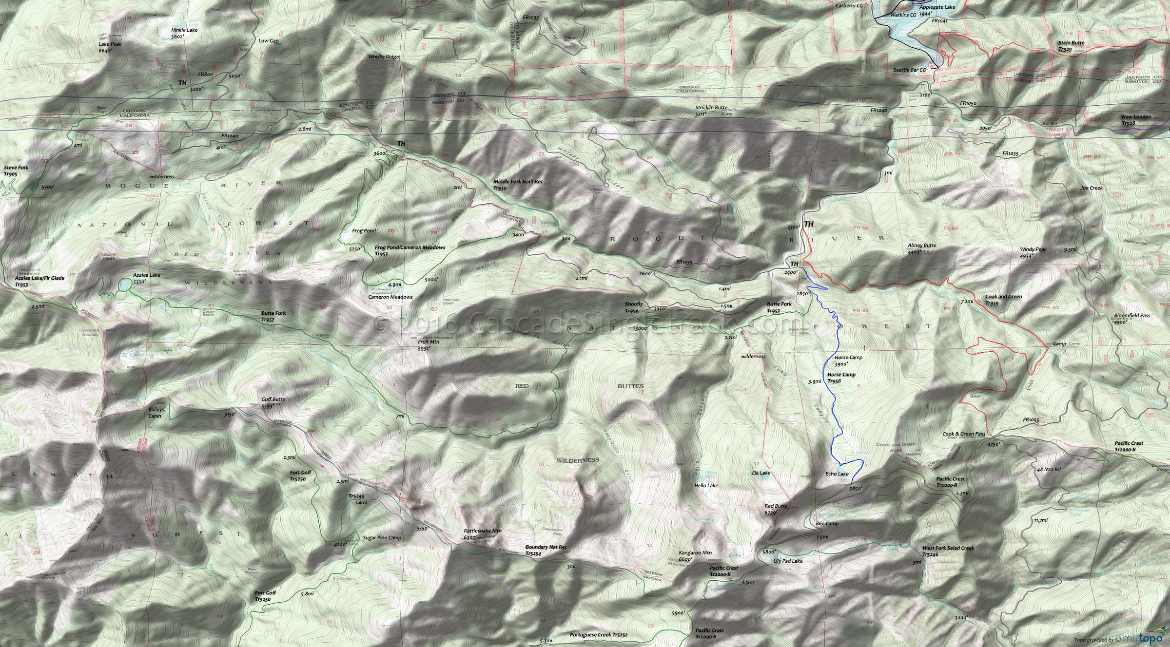
Cook and Green Mountain Biking and Hiking Topo Map
Map includes: Cook and Green Trail 959, Horse Camp Trail 958, Pacific Crest Trail 2000-R, Butte Fork Trail 957, Frog Pond/Cameron Meadows Trail 953, Middle Fork National Recreation Trail 950, West Fork Seiad Creek Trail 5246.
TH: Ascend or hike-a-bike for the first 2mi, then cross a creek and continue over more moderate terrain, with a shale terrain transitioning to moderate root covered surface.
3.7mi: Pass the No-See-Um camp, then cross Cook and Green creek and ascend the Bear Gulch creek draininge.
4.2mi: Cross Bear Gulch creek and switchback traverse the forested and open field hillside to the 6.6mi Bear Gulch creek crossing.
7.2mi: Cross another Bear Gulch creen tributary and reach the Cook and Green Pass, then enjoy the downhill back to the TH.
Draggable map: Map window adjusts to screen size and will respond to touch control. Use scrollbar for mouse control.
No Map? Browser settings and some browser extensions can prevent the maps from appearing. Please see Site Tech


