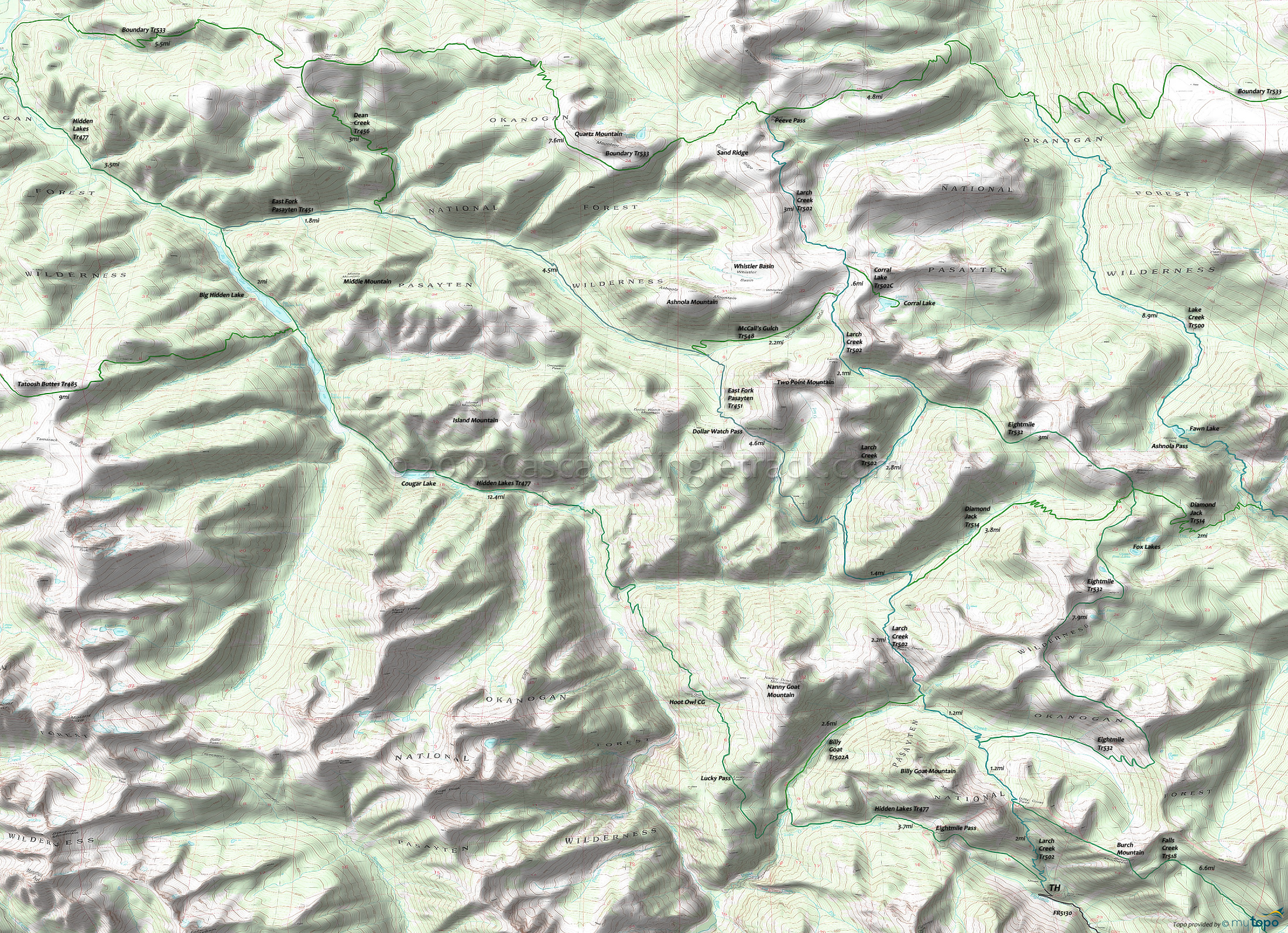
Boundary Trail 533, Diamond Jack Trail 514 and Hidden Lakes Trail 477 Area Hiking Topo Map
Map includes: Boundary Trail 533, Diamond Jack Trail 514, Eightmile Trail 532, Hidden Lakes Trail 477, Lake Creek Trail 500, Larch Creek Trail 502, East Fork Pasayten Trail 451 and Tatoosh Buttes Trail 485 Hiking Trails.
Boundary Tr533 is the main east-west Pasayten Wilderness crossing, connecting the major north-south trails such as Robinson Creek Tr478, Hidden Lakes Tr477, Larch Creek Tr502 and Lake Creek Tr500. The terrain varies from timbered valleys to long sidehills and high ridges, with much of the eastern section above the timberline.
Hidden Lakes Tr477 is a popular trail which leads to a string of fishing lakes with fine views for the first 7mi, through timber and valley bottom to the lakes. There is a pass between Middle and Big Hidden lakes with Big Hidden draining north to Canada, with the rest of the lakes draining south via the Lost River to the Methow River. Lost River can be reached by taking a side path about 100 yards south of Diamond Cr. The short, steep path reaches scenic meadows and sand bars along the river. Loop trips can be made with the Sheep Mountain area by using the East Fork Pasayten Tr451 over Dollar Watch Pass, or using McCall Gulch Tr548 or Boundary Tr533 over Bunker Hill. From the Sheep Mountain area Larch Creek Tr502 returns to the Hidden Lakes FR5130 TH.
Diamond Jack Tr514 is a Larch Creek Tr502 spur, just south of Diamond Creek, ascending the Diamond Creek Valley in timber to a 7100' pass before descending into the Fox Creek drainage to the junction with the Lake Creek Tr504. There are some scenic areas near the pass and two Fox lakes nearby can be reached via some unmarked trails. An unmarked trail to the ridge north of the pass leads to the top of Diamond Point, an old lookout site with views of the Ashnola drainage.
Draggable map: Map window adjusts to screen size and will respond to touch control. Use scrollbar for mouse control.
No Map? Browser settings and some browser extensions can prevent the maps from appearing. Please see Site Tech


