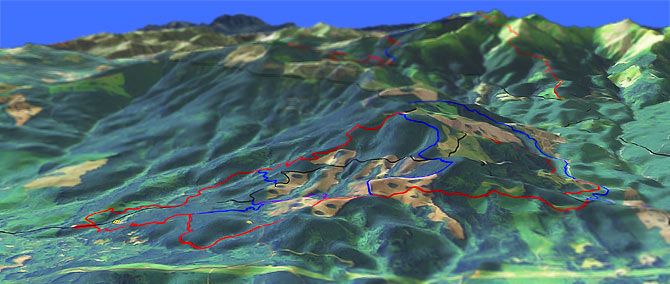
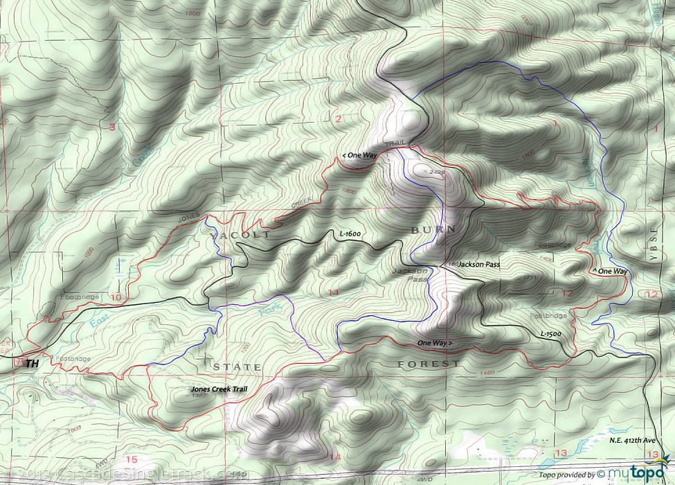
Jones Creek Trails

Overall: 4
Aerobic: 4
Technical: 4
Steepness: 4
Flow: 5
Singletrack: 100%
Short, relatively flat and favored by Orv, Jones Creek is no destination ride, but this small trail system is close to Vancouver and so is an easily accessible, popular area.
Type
Loop
Length
Avg: 9.5mi
Ascent
Moderate
Elevation Change
TH:850'
Avg Ascent:2600'
Ascent Incline
13%
Duration
Avg: 1.5hr
Weather
Forecast
NOAA
popup
WA DNR
Silver Star Area Trails
At the edge of the Gifford Pinchot National Forest, this system of trails has three main trailheads, at Tarbell, Silver Star and Grouse Creek Vista.
Near Vancouver, the Silver Star area trails are popular with hikers, bikers and equestrians. As a result, the trails get a lot of use and receive good maintenance. There is enough terrain variety and trail length to create decent weekend destination rides, but not the kind of epic rides found further into the Gifford Pinchot National Forest.
Each of these trails offers a different ride profile, to meet the needs of most intermediate riders. Nearby Bells Mt is a good trail for those seeking easier terrain, but good shuttle opportunities on the other trails creates opportunities for advanced beginners.
With the exception of a 1.6mi (1150') climb, this Yacolt Burn State Forest terrain is relatively flat, although this doubletrack trail can become quite rough from Orv use.
Ding: As with most DNR trails, avoid this trail from Friday afternoon through Sunday afternoon, due to heavy Orv use.
To avoid user conflicts, this rough trail is a unidirectional CCW loop ride.
There are several connector trails, so a figure 8 ride is probably ok during the week.
There are a number of other trails surrounding the Jones Creek trail, all of which are for ORV use and so should be avoided.
Bells Mountain provides a better ride option, offering both singletrack and less chance of being run over.
Directions: SR500E to Fourth Plain (1st light) and turn right, continuing on SR500E to Camas. Go 6.3mi then go left onto 53rd St. Go 3.2mi then go left onto Ireland Rd. Go .3mi then go left onto Lessard Rd, then go 4mi and follow signs to Jones Creek ORV. View Larger Map. No Map?.

Loop Directions
race track
- TH: Ride CCW from the campground. There are several footbridges and some connector trails. If traffic is light then use the connector trails to do a figure eight.
Three Corner Rock, Beacon Rock State Park Hiking
As with Bluff Mountain trail, Three Corner Rock is open to biking but not advised for most riders. Consider a shuttle if attempting to ride the trail and expect to do some scrambling along the often-rugged terrain.
Trail Index
This Ride
Jones Creek Orv Trail
Area
Bells Mountain Trail, Indian Pit Trail 180E, Larch Mountain Trail 441, Silver Star Summit Trail 180D, Sturgeon Rock Trail 180C
Hiking
Beacon Rock Hardy Creek Trail, Beacon Rock Hamilton Mountain Trail, Three Corner Rock Trail, Pacific Crest Trail 2000-H
Campgrounds
Beacon Rock Campgrounds, Dougan Creek Campground
Trail Rankings
Ranking consistently applied to all of the listed trails.
- Overall Rating: Ride quality and challenge
- Aerobic: Ascent challenge
- Technical Difficulty: Terrain challenge
- Steepness: Average incline
- Flow: Uninterrupted riding
- Elevation Change: Total elevation gain
- Ride Difficulty: Terrain challenge


