Bells Mountain Trail
Twitter Search
#moultonfalls

Overall: 6
Aerobic: 6
Technical: 5
Steepness: 5
Flow: 7
Singletrack: 100%
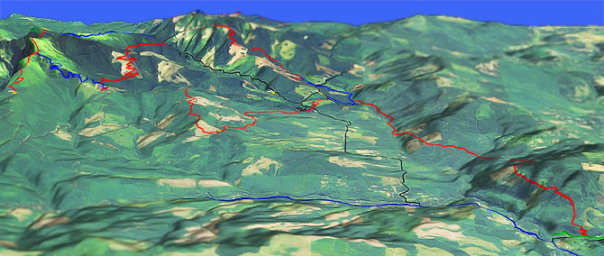
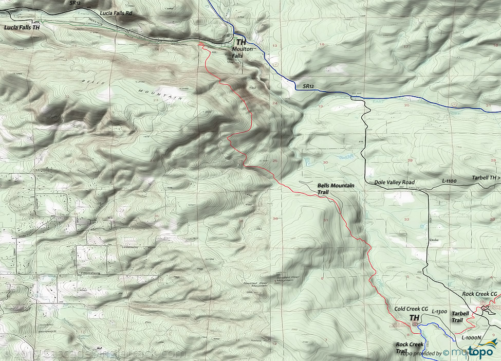
The Vancouver Washington Bells Mountain trail is a nice OAB which traverses the eastern flank of Bells mountain and Spotted Deer mountain, ending at the Cold Creek campground.
Type
OAB
Length
Avg: 14mi
Ascent
Moderate
Elevation Change
TH:560'
Avg Ascent:3500'
Ascent Incline
15%
Duration
Avg: 2hr
Weather
Forecast
NOAA
popup
WA SP
Trail
Review
Silver Star Area Trails
At the edge of the Gifford Pinchot National Forest, this system of trails has three main trailheads, at Tarbell, Silver Star and Grouse Creek Vista.
Near Vancouver, the Silver Star area trails are popular with hikers, bikers and equestrians. As a result, the trails get a lot of use and receive good maintenance. There is enough terrain variety and trail length to create decent weekend destination rides, but not the kind of epic rides found further into the Gifford Pinchot National Forest.
Bells Mt is a good trail for those seeking easier terrain, with good shuttle opportunities on the other trails creating opportunities for advanced beginners.
Ding: From Moulton Falls, the first mile ascends 1000', a 19% grade which will be a hike for many riders.
Those seeking an easier ride could start from the Cold Creek Campground and ride north 6mi.
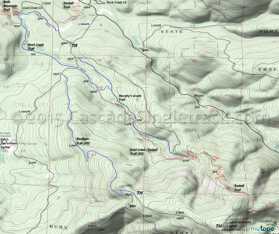
The ride can be extended by continuing on the Tarbell trail to Larch Mountain, which increases the ascent and technical aspects of the ride enough for intermediate riders. See the Area Map for more info on the Larch Mountain route.
The Cold Creek chapter of the Evergreen Alliance has built some freeride terrain on Thrillium and Cold Creek, and holds event and work parties to support the trail system.
The Thrillium and Cold Creek are intended to be downhill routes, using L1000N and Murphy's Grade for ascent to the upper TH.
TH parking is alongside L1000N and L1300 (to the Cold Creek CG), on one side of the road. CG parking is by permit only.
Note: The Tarbell section between Rock Creek Campground and the Tarbell TH is very popular with equestrians and can become unrideable due to trail damage.
That trail section includes several bail out points to L1210, if needed.
To the south, Jones Cr Orv is another moderate trail loop worth checking out.
Directions: From Battle Ground, go on Lucia Falls Park Rd to Moulton Falls. Go .5mi through park on pedestrian walkway and over the bridge to the TH. View Larger Map. No Map?.

OAB Directions
larch ascent
- TH: Ascend 1000' in 1mi, then traverse the eastern flank of Spotted Deer mountain, across undulating hillside terrain, to the Cold Creek CG.
- 7.1mi: At the Cold Creek CG, turn around and go back, or continue on the Rock Creek to Larch Mountain Trail.
Trail Index
This Ride
Bells Mountain Trail, Cold Creek Trail, Rock Creek Trail, Tarbell Trail
Area
Hiking
Bluff Mt Trail 172, Ed's Trail 180A, Moulton Falls Trail, Starway Trail 175
Campgrounds
Cold Creek Campground, Rock Creek Campground, Sunset Campground
Trail Rankings
Ranking consistently applied to all of the listed trails.
- Overall Rating: Ride quality and challenge
- Aerobic: Ascent challenge
- Technical Difficulty: Terrain challenge
- Steepness: Average incline
- Flow: Uninterrupted riding
- Elevation Change: Total elevation gain
- Ride Difficulty: Terrain challenge


