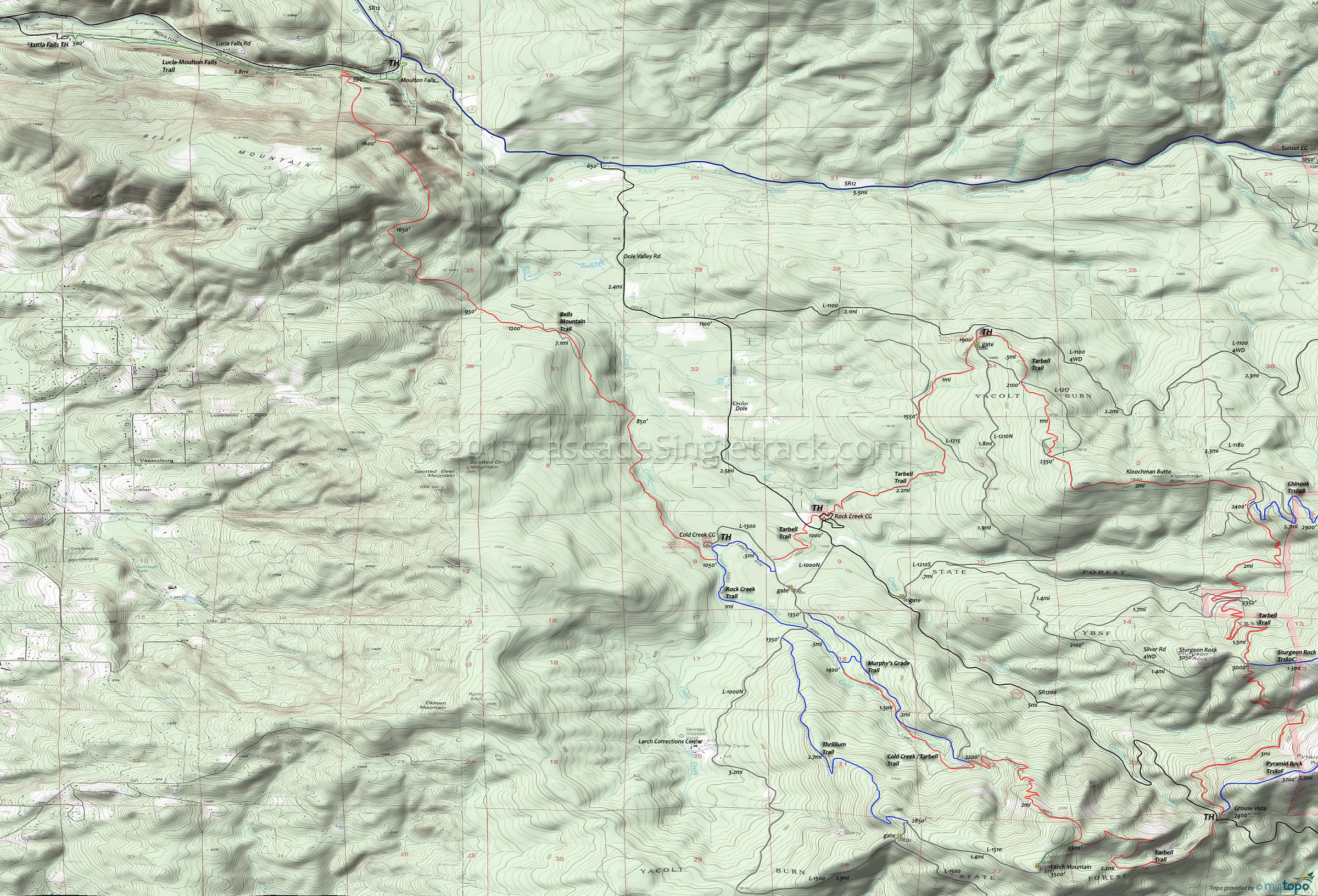
Bells Mountain Trail Area Mountain Biking and Hiking Topo Map
Map includes Bells Mountain Trail, Chinook Trail 180B, Pyramid Rock Trail 180F, Silver Star Summit Trail 180D, Sturgeon Rock Trail 180C and Tarbell Trail Mountain Biking and Hiking Trails.
TH: Ascend 1000' in 1mi, then traverse the eastern flank of Spotted Deer mountain, across undulating hillside terrain, to the Cold Creek CG.
7.1mi: At the Cold Creek CG, turn around and go back, or continue on the Rock Creek to Larch Mountain Trail.
Draggable map: Map window adjusts to screen size and will respond to touch control. Use scrollbar for mouse control.
No Map? Browser settings and some browser extensions can prevent the maps from appearing. Please see Site Tech


