Twitter Search
#OregonTimberTrail
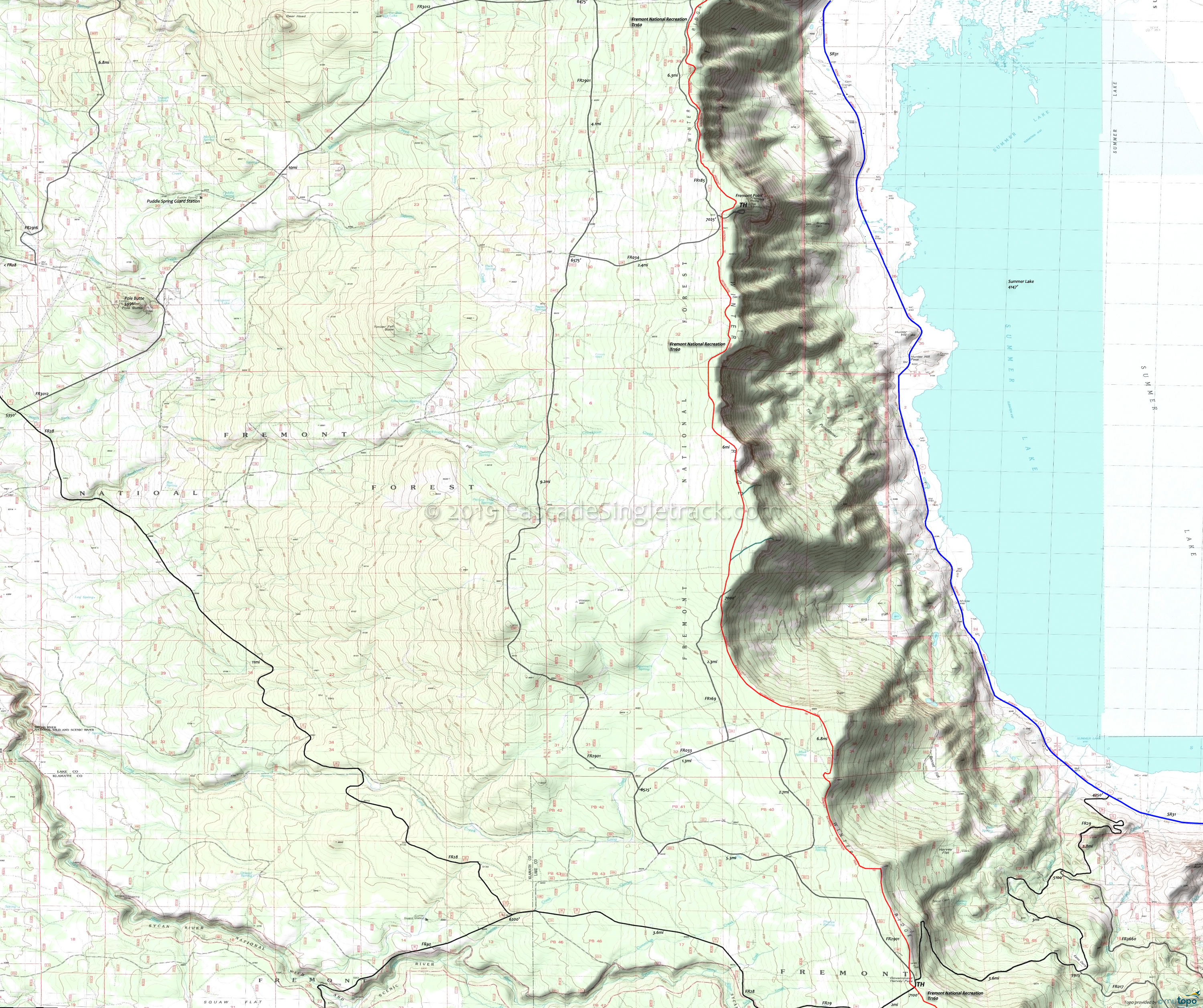
Fremont National Recreation Trail Mountain Biking and Hiking Topo Map
This map covers the Fremont National Recreation Trail from Fremont Point to the Government Harvey Pass TH.
Oregon Timber Trail: The Fremont National Recreational Trail is part of the Fremont Tier route.
At the edge of the Winter Rim fault block, Fremont Point offers sweeping views of Summer Lake and the valley 2000' below.
The northern segment passes through varied terrain, including open ponderosa pine, alpine meadows, lodgepole pine, mountain mahogany thickets, and colorful rock outcrops.
From Farmwell Horse Camp to Government Harvey Pass, this 32mi segment of the Fremont National Recreational Trail involves an ascent of 3100' (mostly from Farmwell to Winter Ridge), requiring intermediate climbing and technical skills.
Other segments of the FRT are covered on the Hanan Tr142 and Crane Mountain Trail 161 pages.
Mosquitoes are ferocious in this area until August. Feel free to try the natural repellents, and avoid drinking carbonated drinks prior to riding, but Deet 100 may be the only protection from 'the swarm'. Expect some trailside poison oak and prepare as needed. Try using Tecnu before the ride.
Draggable map: Map window adjusts to screen size and will respond to touch control. Use scrollbar for mouse control.
No Map? Browser settings and some browser extensions can prevent the maps from appearing. Please see Site Tech


