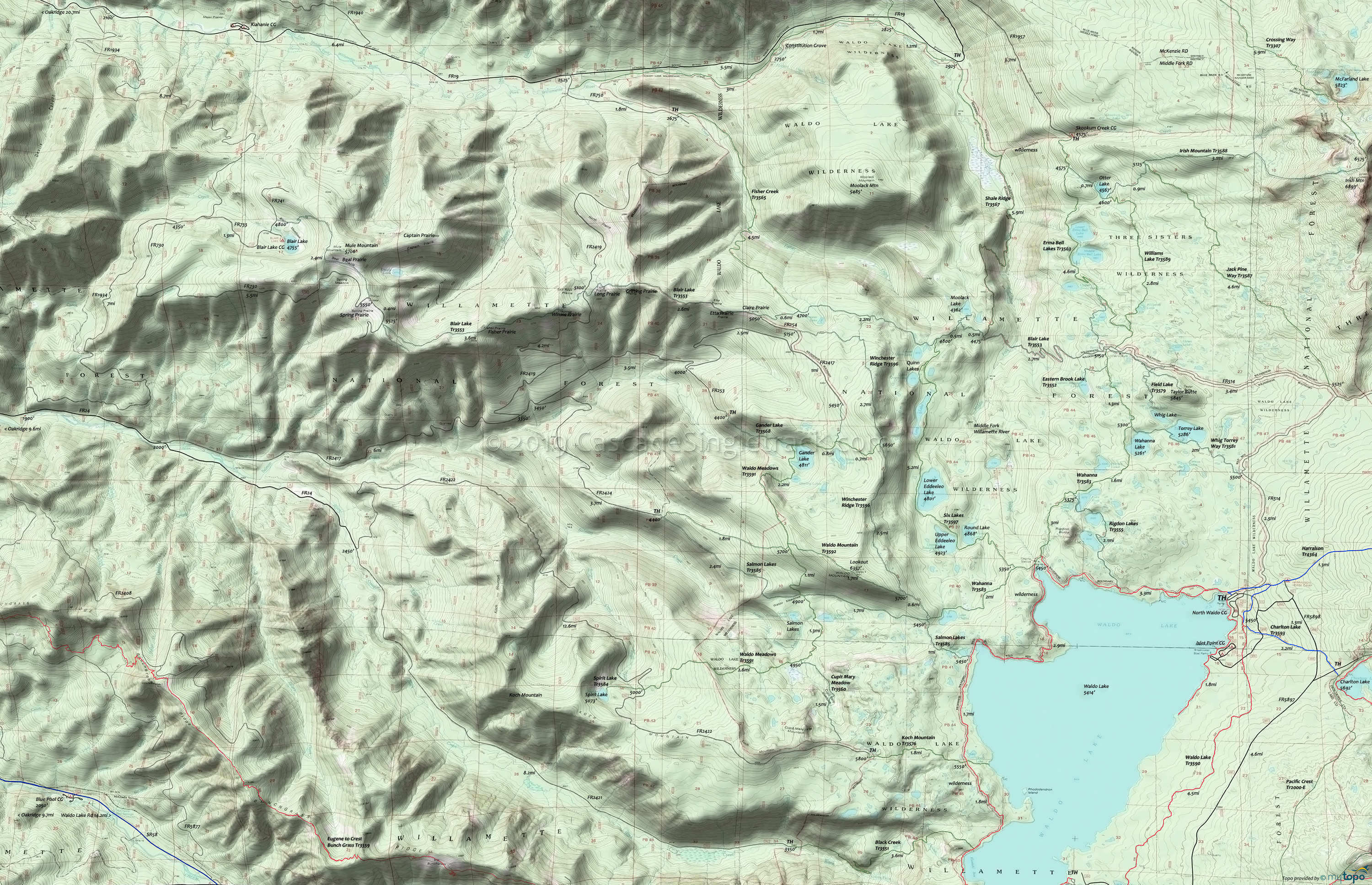
Jack Pine Way Trail 3587, Waldo Mountain Trail 3592 and Winchester Ridge Trail 3596 Area Hiking Topo Map
Map includes: Blair Lake Trail 3553, Erma Bell Lakes Trail 3563, Jack Pine Way Trail 3587, Six Lakes Trail 3597, Wahanna Trail 3583, Waldo Meadows Trail 3591, Waldo Mountain Trail 3592, Williams Lake Trail 3589 and Winchester Ridge Trail 3596 Hiking Trails.
The Taylor Burn area trails at the north end of Waldo Lake are easily accessible from the North Waldo CG. FR514 is not maintained, so should be considered a jeep trail. From the north, FR1957 leads to the Skookum Creek CG, the northern Erma Bell Lakes Tr3563 TH. Jack Pine Way Tr3587 and a short section of Irish Mountain Tr3588 could be added to create a challenging day-hike loop from the Skookum Creek CG. Williams Lake Tr3589 is a primitive trail which passes through several meadows and includes several steep hikes in and out of drainages.
Blair Lake Tr3553 is a 15mi ridgeline trail at the northern boundary of this trail system and extends from FR514 to the Blair Lake CG, passing through a series of ridgeline prairie meadows along the way. Note: The North Fork of the Middle Fork Willamette River is at the bottom of a steep drainage and can usually be crossed on nearby logs found off to the right of the trail, but may be impassible or dangerous during the Spring runoff.
Whig & Torrey Way Tr3581 and Wahanna Tr3583 combine with Waldo Lake Tr3590 and FR514 to form a moderate day-hike loop around the Taylor Burn area.
Winchester Ridge Tr3596 and Six Lakes Tr3597 combine to form a challenging day-hike loop, with numerous small campsites alongside both trails.
Draggable map: Map window adjusts to screen size and will respond to touch control. Use scrollbar for mouse control.
No Map? Browser settings and some browser extensions can prevent the maps from appearing. Please see Site Tech


