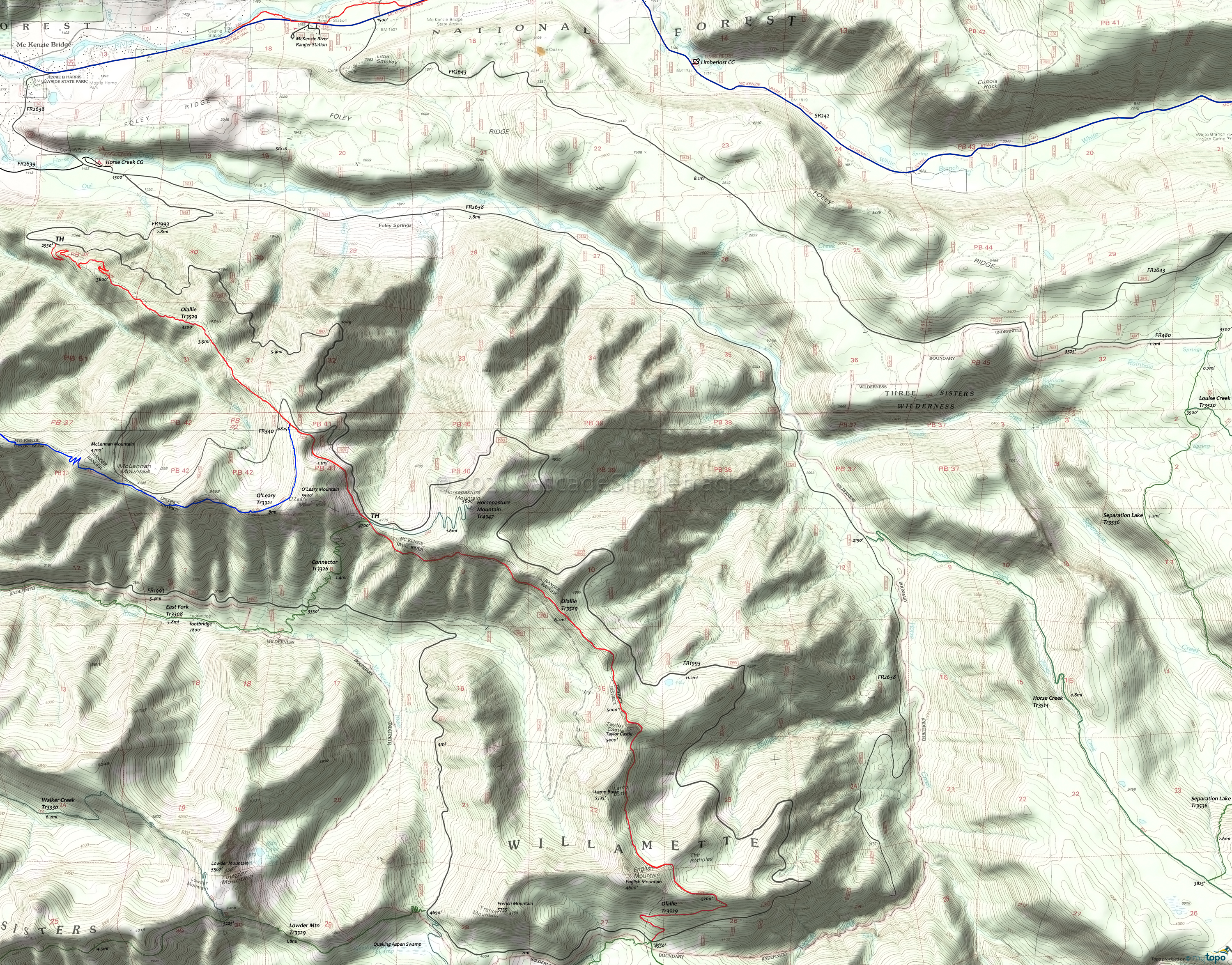
Olallie Area Mountain Biking and Hiking Topo Map
Map includes Olallie Trail 3529 Mountain Bike trail and access to the Willamette NF Three Sisters Wilderness Hiking Trails.
Olallie OAB
TH: Climb/Hike 3mi to the top of the ridge, or park at the upper FR1993 TH (near the O'Leary Mountain summit) and ride 17mi to the end of the ridge from there, then return.
7.4mi: After the FR1993 intersection, climb several hundred feet then descend, followed by a climb to Taylor Castle summit. The trail levels off while riding below the ridgeline past Lamb Butte and English Mountain, followed by a steep descent to FR1993. Turn around just prior to the steep FR1993 descent and return to the TH.
To ride just the Olallie ridgeline, park at the FR340 gate then ride south to just past English Mountain.
Draggable map: Map window adjusts to screen size and will respond to touch control. Use scrollbar for mouse control.
No Map? Browser settings and some browser extensions can prevent the maps from appearing. Please see Site Tech


