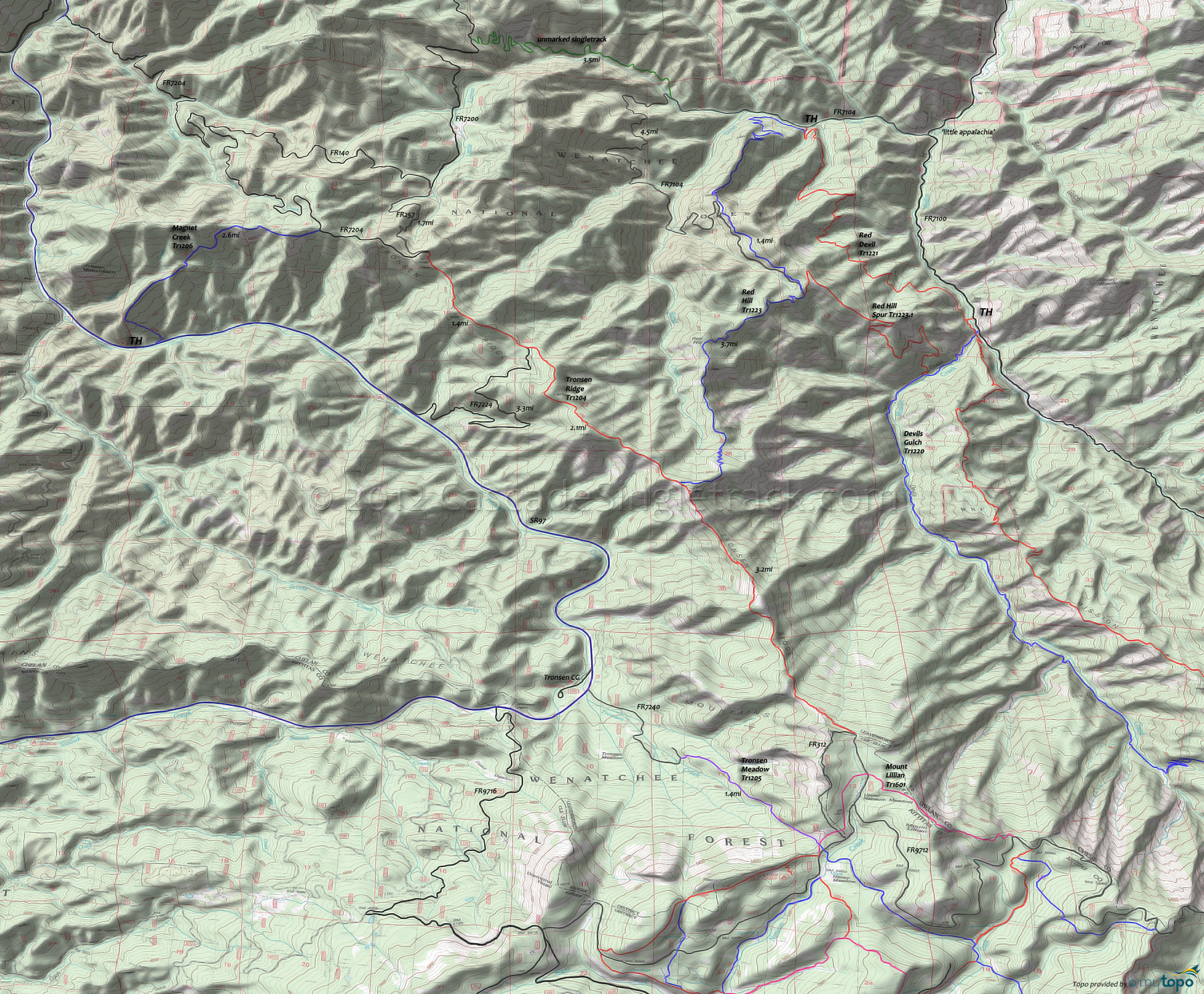
Tronsen Ridge Trail 1204 Area Mountain Biking and Hiking Topo Map
Map includes: Devils Gulch Trail 1220, Magnet Creek Trail 1206, Red Devil Trail 1221, Red Hill Trail 1223, Red Hill Spur Trail 1223.1, Tronsen Meadow Trail 1205 and Tronsen Ridge Trail 1204 Mountain Biking and Hiking Trails.
Magnet Creek, Tronsen Ridge OAB
TH: Hike/crawl .5mi to the ridgeline over extremely steep terrain, then ride as much as possible along the sloping ridgeline to the 2.4mi crest, crossing a creek in the saddle between the spur ridge and Tronsen Ridge.
2.6mi: Go right onto FR7204, descending along the main ridgeline, crossing FR251 at 2.8mi.
3.6mi: At the sharp curve, go straight onto Tronsen Ridge Tr1204, descend to a saddle, then climb to a peak at 4.3mi.
4.8mi: Tronsen Ridge Tr1204 briefly merges with FR7224, breaking off to the left at 5mi. Go around a knoll while ascending to a 6.2mi peak, then descend to the Red Hill Tr1223 intersection at 7.1mi.
8.1mi: After riding along the ridge, complete the final ascent to FR312 at Upper Naneum Meadow, with a little break at 8.9mi while riding around a knoll.
10.3mi: Reach FR312, then return to the TH.
Option: Continue the ride to Mount Lillian, on FR312 and Mount Lillian Tr1601.
Draggable map: Map window adjusts to screen size and will respond to touch control. Use scrollbar for mouse control.
No Map? Browser settings and some browser extensions can prevent the maps from appearing. Please see Site Tech


