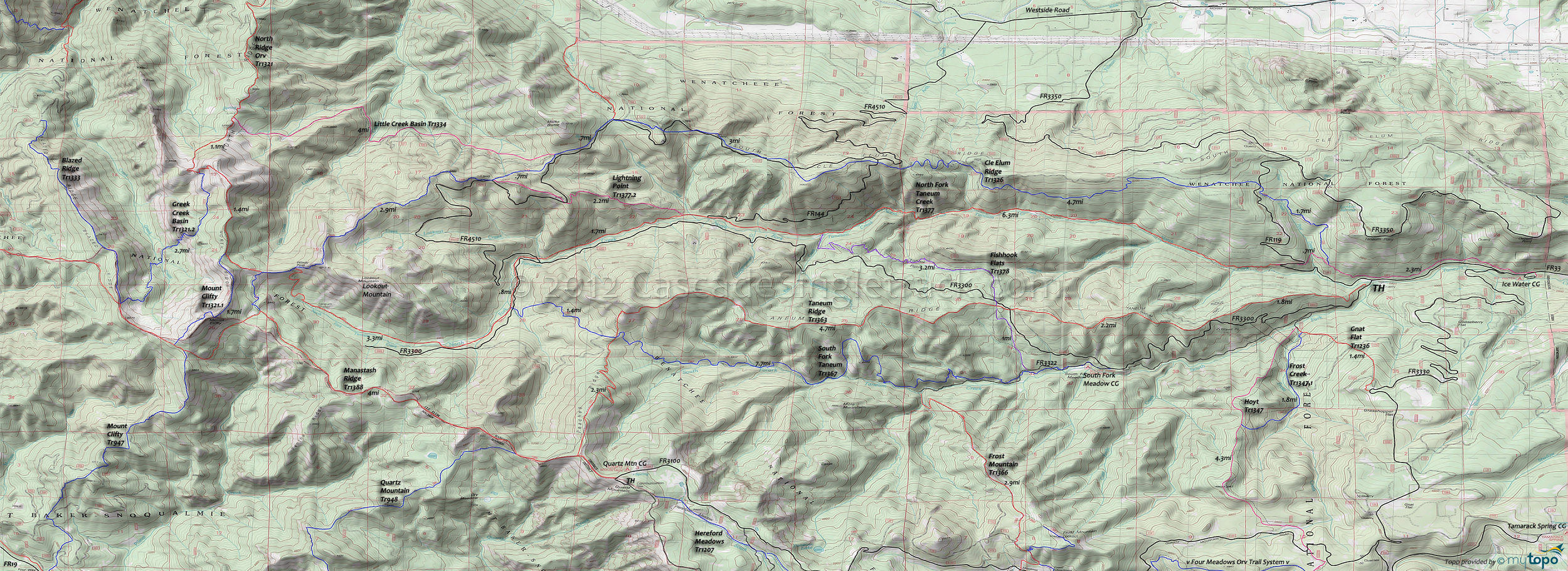
North Fork Taneum Trail 1377 and Taneum Ridge Trail 1363 Area Mountain Biking and Hiking Topo Map
Map includes: Cle Elum Ridge Trail 1326, Fishhook Flats Trail 1378, Lightning Point Trail 1377.2, Little Creek Basin Trail 1334, Manastash Ridge Trail 1388, North Fork Taneum Trail 1377, Taneum Ridge Trail 1363 and South Fork Taneum Trail 1367 Mountain Biking and Hiking Trails.
North Fork Taneum Tr1377 to Taneum Ridge Tr1363 creates a 20mi (4800' ascent) CCW loop, with moderate climbing leading to a steep Taneum Ridge Tr1363 ridgeline descent.
Draggable map: Map window adjusts to screen size and will respond to touch control. Use scrollbar for mouse control.
No Map? Browser settings and some browser extensions can prevent the maps from appearing. Please see Site Tech


