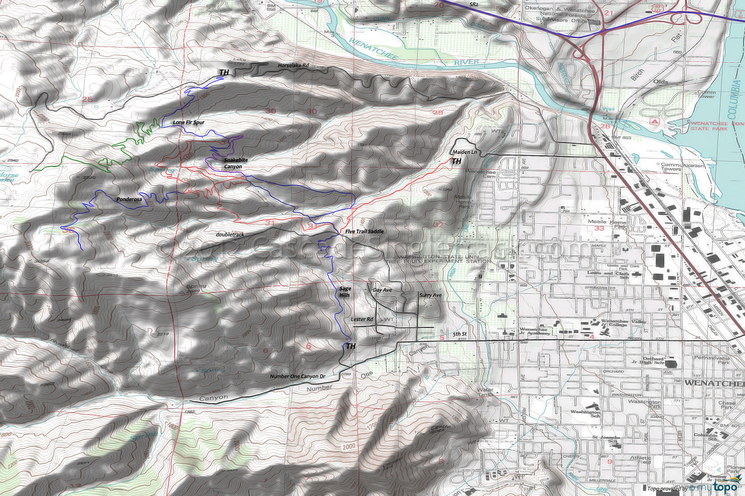
Sage Hills Area Mountain Biking and Hiking Topo Map
Map includes: Sage Hills Trail, Foothills Trail, Gut Saddle Trail, Homestead Trail, Ponderosa Ridge Trail, Snakebite Trail Mountain Biking and Hiking Trails.
TH: From Sage Hills road, climb Lester Trail (sometimes called Sage Hills Trail) to the 5-trail saddle intersection.
1.5mi: Bear to the left, then bear to the right at 1.6mi, onto 'Gut Saddle' trail, cross a creek and ascend to the ridgeline.
2.3mi: Crest the ridge then pass through several intersections onto 'Snakebite Canyon' trail. Cross a creek at 2.6mi then traverse the steep hillside to the ridgeline.
3.2mi: Cross the Lone Fir Spur trail intersection and pass the ride summit, descending the ridge on 'Coyote Canyon' trail, passing a 4 way intersection at 3.9mi.
5mi: Cross a creek at 4.3mi then continue the descent to the intersection, then bear right to go to the 5-trail saddle intersection and back to the TH.
Draggable map: Map window adjusts to screen size and will respond to touch control. Use scrollbar for mouse control.
No Map? Browser settings and some browser extensions can prevent the maps from appearing. Please see Site Tech


