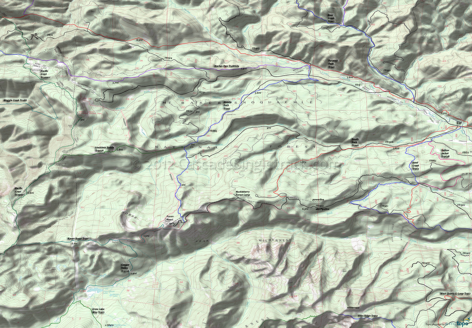
Middle Fork Trail and Raven Roost Trail Area Mountain Biking and Hiking Topo Map
Twitter Search
#PacificCrestTrail
Map includes: Louisiana Saddle Trail 945A, Middle Fork Trail 945, Pacific Crest Trail 2000-I, Pyramid Peak Trail 941, Raven Roost Trail 951, Sand Creek Trail 963, South Fork Trail 946 and Yellow Jacket Trail 963B Mountain Biking and Hiking Trails.
TH: From the FR1909 TH ascend South Fork Tr946, which crosses FR686 then crosses to the left side of FR1906 at .8mi, then parallels Sand Creek Tr963 before crossing to the right side of FR1906 at 2.1mi, finally veering off to the left of FR1906 at 2.5mi.
2.5mi: After crossing FR1906, hike-a-bike up the steep slope to the knoll ridgeline, which will be up to .5mi depending on climbing ability. After passing the knoll on the right, continue the steep ascent to FR1902.
5mi: Cross the ridgeline and go right onto FR1902, near the Sand Creek headwaters. Pass FR865 and the Huckleberry Forest Camp on the right at 6.2mi, followed by a final push to the Middle Fork Tr945 intersection.
7.8mi: Go right onto Middle Fork Tr945 at the fork (the ride summit), with an option to continue .6mi (300' ascent) on FR1902 to the Raven Roost peak. Continue along the left side of ridge then switchback steeply into the valley.
10.2mi: Pass FR1906 on the right at 9.7mi, descend to and cross the South Fork Little Naches River bridge, followed by a steep but brief climb to a T. Go right then cross FR791 and parallel FR884 on the right, then descend to the County Creek drainage and ride alongside FR1912 across moderate terrain, crossing it several times before switchbacking to FR19.
14.5mi: Cross FR19 then use FR1913 to cross the Little Naches River, and go right onto Pyramid Peak Tr941 and ride the riverside terrain back to the South Fork Tr946 TH, then ride back to the FR1906 TH.
Draggable map: Map window adjusts to screen size and will respond to touch control. Use scrollbar for mouse control.
No Map? Browser settings and some browser extensions can prevent the maps from appearing. Please see Site Tech


