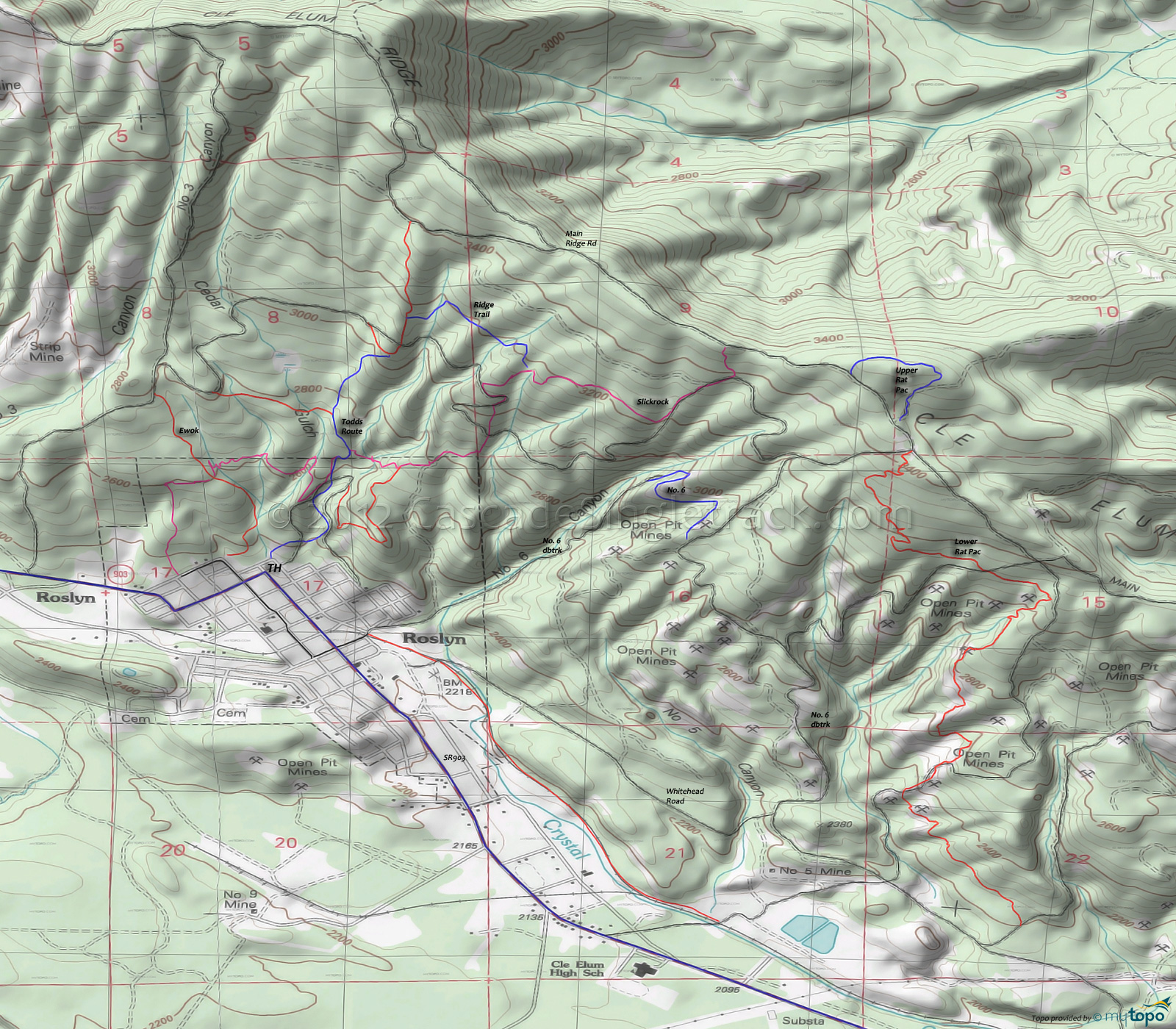
Rat Pac Area Mountain Biking and Hiking Topo Map
Map includes: Ewok Trail, Lower Connector Trail, Lower Rat Pac Trail, Number 6 Trail, Ridge Trail, Slickrock Trail, Todds Route and Upper Rat Pac Trail Mountain Biking and Hiking Trails.
TH: From the west side of Roslyn, ascend Ewok for .9mi, then go right onto the fireroad and ascend to Slickrock .
2.1mi: Go left on the singletrack then bear right at the next fork, onto Slickrock.
3.2mi: After traversing the hillside on Slickrock, go left onto the fireroad and ascend .2mi to the singletrack on the left, which leads to Main Ridge Rd. Go right on Main Ridge Rd, to Upper Rat Pac at 3.8mi, and loop around to rejoin Main Ridge Rd.
4.4mi: From Main Ridge Rd, go right onto Lower Rat Pac and descend the hillside, crossing fireroads at 5.3mi and 6.4mi, before merging with a fireroad at 7.3mi.
8.4mi: Descend to the railroad tracks and head back to Roslyn.
Draggable map: Map window adjusts to screen size and will respond to touch control. Use scrollbar for mouse control.
No Map? Browser settings and some browser extensions can prevent the maps from appearing. Please see Site Tech


