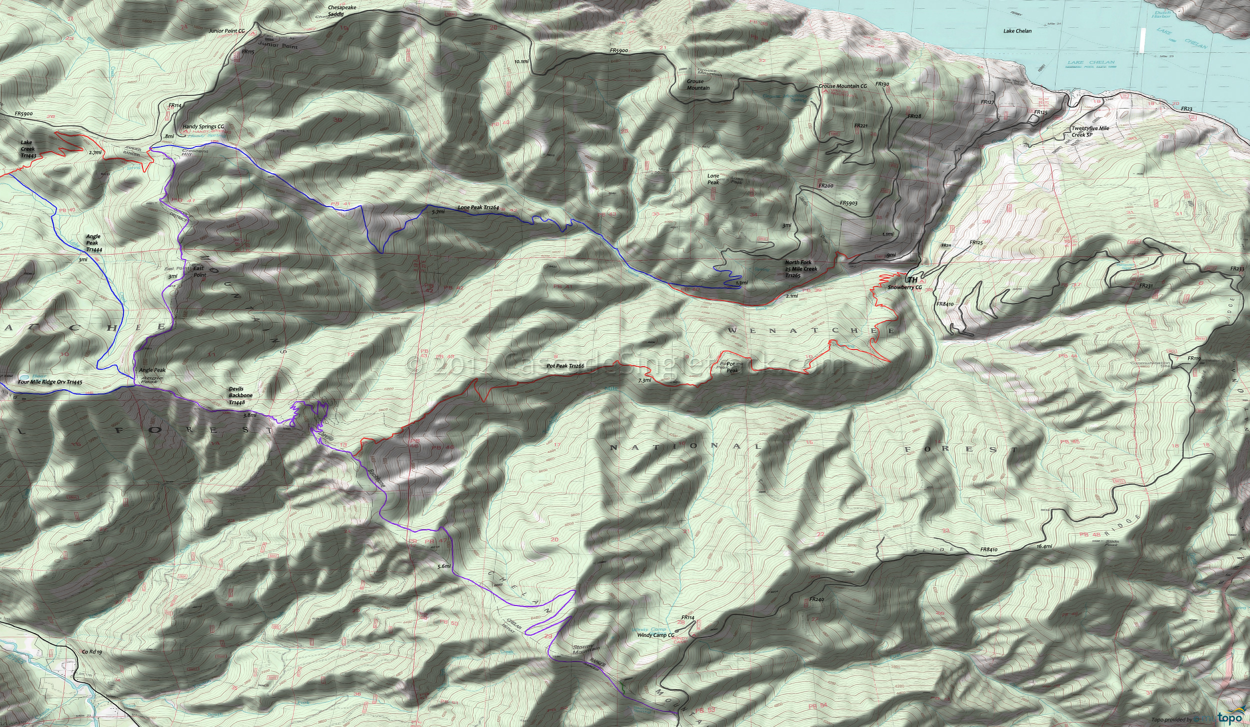
Devils Backbone Orv Trail 1448 and Pot Peak Trail 1266 Area Mountain Biking and Hiking Topo Map
Map includes: Devils Backbone Orv Trail 1448, Lone Peak Trail 1264, North Fork Twentyfive Mile Creek Trail 1265, Pot Peak Trail 1266 Mountain Biking and Hiking Trails.
TH: From the Snowberry Bowl campground, ride FR8410 .5mi back to FR5900 and go left. Pass the 25 Mi. Cr. Tr1265 TH on the left at 1.4mi and FR5903 on the left at 2.5mi.
6mi: Pass the Grouse Mountain campground on the right, then circumnavigate the Grouse Mountain summit at 6.7mi. The ascent incline moderates at 10.3mi, descending to Chesapeake Saddle.
10.9mi: Climb from Chesapeake Saddle, past the Junior Point campground at 11.7mi, reaching FR114 at 12.6mi. Go left onto FR114, past the Handy Spring campground on the left, to the Devils Backbone Orv Tr1448 TH. Ride or hike the first .2mi, to the 3-way intersection.
13.3mi: Go straight at the 3-way TH, onto Devils Backbone Orv Tr1448, with a short climb which reaches the ride 6878' East Point summit at 14.3mi. Descend to the Angle Pk Tr1444 intersection on the right at 16.3mi, followed by the Four Mile Ridge Tr1445 intersection, bearing left to stay on Devils Backbone Orv Tr1448.
17.7mi: Ride around a talus slope, with a switchback descent followed by a .8mi talus hike-a-bike over the rough terrain.
20.4mi: Go left onto Pot Peak Orv Tr1266, with a ridgeline descent to the Pot Peak summit at 24mi, with the trail falling off the ridgeline after a sharp left curve at 25.8mi.
27mi: Cross a creek then begin the steep .8mi switchback descent to the TH.
Draggable map: Map window adjusts to screen size and will respond to touch control. Use scrollbar for mouse control.
No Map? Browser settings and some browser extensions can prevent the maps from appearing. Please see Site Tech


