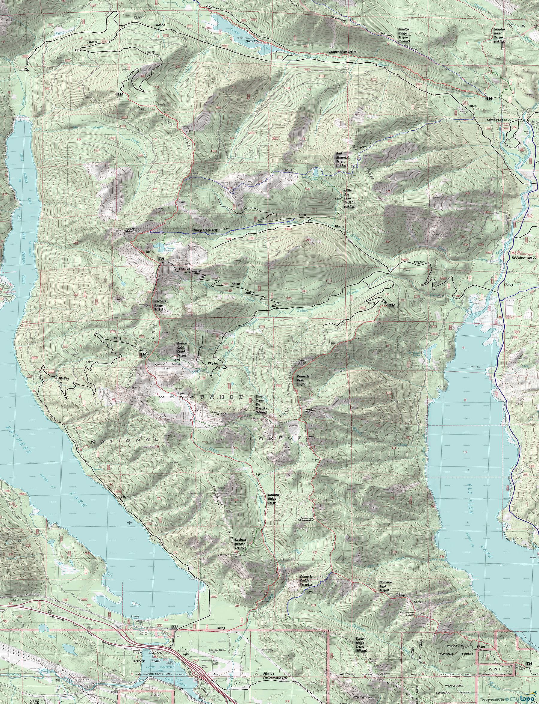
Kachess Ridge Trail 1315 and Red Mountain Trail 1330 Area Mountain Biking and Hiking Topo Map
Map includes: Domerie Peak Trail 1308, Easton Ridge Trail 1212, French Cabin Creek Trail 1305, Kachess Ridge Trail 1315, Red Mountain Trail 1330, Silver Creek Tie Trail 1308.1 and Thorp Creek Trail 1316 Mountain Biking and Hiking Trails.
TH: Ride 5.8mi alongside Kachess Lake on FR4818, then go right onto FR4824, then another right onto FR115 while ascending 4.7mi to Kachess Ridge.
10.6mi: At the plateau, go left onto the easily missed Kachess Ridge Tr1315, with an initial descent through the French Cabin Meadows Basin followed by a brief climb to the West Peak saddle at 11.2mi.
12.3mi: Pass the hiker-only Silver Creek Tie Tr1308.1 intersection on the left. The trail in this section is technical, with some rocks and roots, plus many creek and Silver Creek crossings to contend with as well.
13.6mi: The trail crosses relatively level terrain for 2mi along the base of Thomas Mountain, passing the Kachess Beacon Tr1315.3 intersection on the right at 15.2mi.
15.9mi: The trail traverses a steep hillside as it switchbacks for 2mi to the valley floor and FR203.
Draggable map: Map window adjusts to screen size and will respond to touch control. Use scrollbar for mouse control.
No Map? Browser settings and some browser extensions can prevent the maps from appearing. Please see Site Tech


