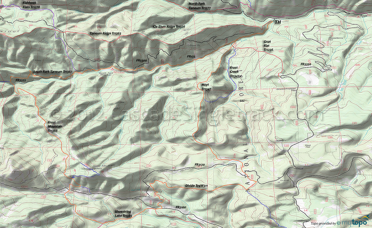
Four Meadows: Frost Mountain Trail 1366 and Hoyt Trail 1347 Area Mountain Biking and Hiking Topo Map
Map includes: Divide Trail 4W311, Frost Mountain Trail 1366, Hoyt Trail 1347, Shoestring Lake Trail 1385, South Fork Taneum Trail 1367 Mountain Biking and Hiking Trails.
TH: Ride FR3300 .5mi to FR135 then left on FR211, then bear right and cross Frost Creek and onto Hoyt Tr1347. An option to hike-a-bike the not-flat Gnat Flat Tr1236 by going left before the creek, with a 1.4mi, 1550' ascent to FR3330. Those seeking a moderate climb should just climb FR3330 from the Ice Water campground intersection.
3.4mi: Hike-a-bike or grind through the steep Hoyt Tr1347 ridgeline ascent, cresting at 3.5mi, merging with FR219 to the end of the doubletrack, then crossing FR3120 at 4.8mi. Ride FR632 as a FR3120 shortcut, then bear right at FR3120, as the singletrack resumes.
5.3mi: Go right onto Divide Tr4W311 at the FR230 intersection, then noodle across the ridgeline above FR3100, over to some doubletrack intersections near where FR3120 meets FR3100. Some pathfinding required in this area, or just dump out to FR3120 and ride to FR3100.
7.8mi: Cross FR3100, onto Shoestring Lake Tr1385, riding along South Fork Manastash Creek.
8.8mi: Go right onto Frost Mountain Tr1366. The trail intersects with and then merges with FR124, then crosses FR3100 at 9.9mi (at Frost Meadows). Bear left at the 10.2mi spur trail, then merge with FR118 at 10.5mi, passing the too-steep Frost Mountain summit trail on the right. Go on FR118 for .1mi then go right onto the singletrack. Ride out the ridgeline, with the serious descent starting at 11.9mi.
13.4mi: At the FR3322 intersection, go onto South Fork Taneum Tr1367 and descend past the South Fork Meadow campground, to the 16.2mi TH, then ride FR3300 to FR135 and back to the TH.
Draggable map: Map window adjusts to screen size and will respond to touch control. Use scrollbar for mouse control.
No Map? Browser settings and some browser extensions can prevent the maps from appearing. Please see Site Tech


