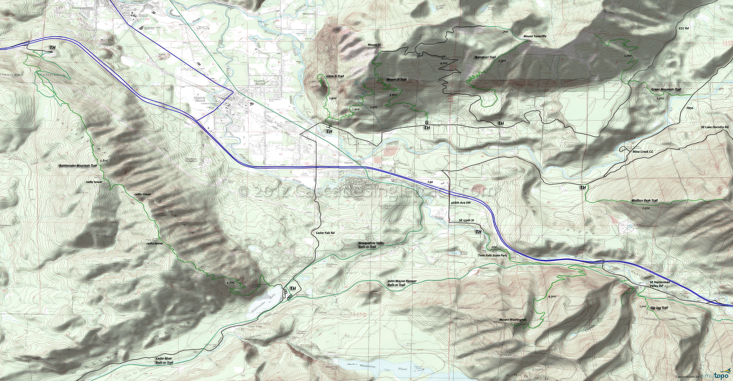
Green Mountain, Mount Si and Mount Washington Area Mountain Biking and Hiking Topo Map
Map includes: Green Mountain Trail, John Wayne Rails to Trail, Kamikaze (to Mount Teneriffe) Trail, Little Si Trail, Mailbox Peak Trail, Mount Si Trail, Mount Washington Trail, Rattlesnake Mountain Trail, Snoqualmie Valley Rails to Trail, Twin Falls Trail, Zig Zag Trail.
Area Hiking: The Middle Fork Snoqualmie Trail 1003 page covers the nearby Baker-Snoqualmie Alpine Lakes Wilderness hiking options.
Closer in, Rattlesnake Mountain is long enough for an all day hike, Mount Si is a very popular hike and there are some hiking trails near the Twin Falls State Park for shorter excursions. WA DNR Mount Si Info.
The unmaintained Kamikaze Trail to Mount Teneriffe starts with a 1mi hike on the abandoned Mount Teneriffe road, then crosses Kamikaze creek and ascends the steep flank of Mount Teneriffe, passing the 150' Kamikaze Falls.
The Twin Falls Recreation Area is the western half of Olallie State Park. The Twin Falls trail is reputed to be the best trail in the area for families with small children, wandering alongside the South Fork Snoqualmie River before crossing at 1.1mi. The southern half of the trail is a slightly tougher climb, too much for most small children.
Draggable map: Map window adjusts to screen size and will respond to touch control. Use scrollbar for mouse control.
No Map? Browser settings and some browser extensions can prevent the maps from appearing. Please see Site Tech


