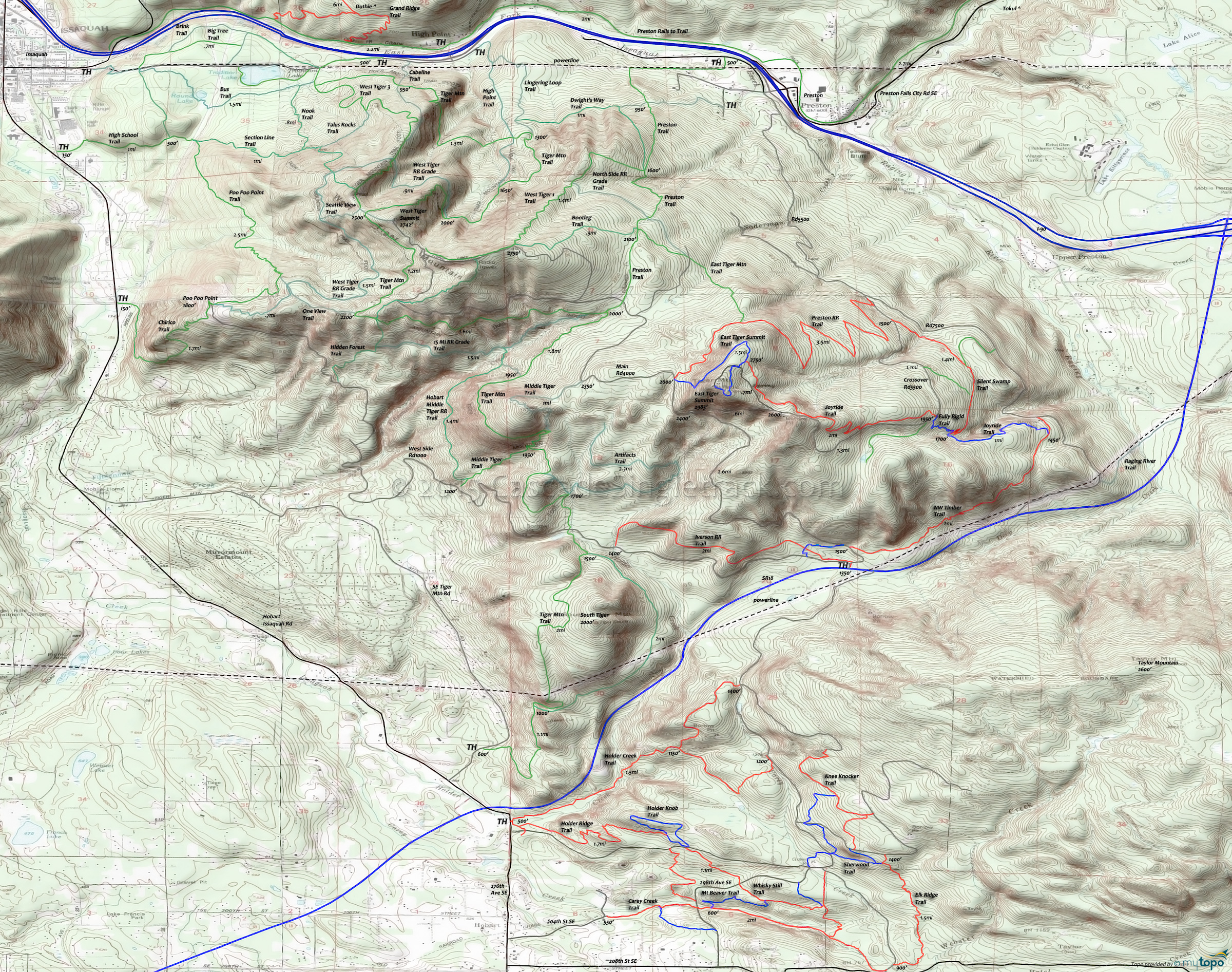
Tiger and Taylor Mountain Trails, Mountain Biking and Hiking Topo Map
Tiger/Taylor Mountain Trails: Beaver Pond Trail, Boot Trail, Carey Creek Trail, Elk Ridge Trail, East Tiger Summit Trail, Fully Rigid Trail, Hermit Trail, Holder Creek Trail, Holder Knob Trail, Holder Ridge Trail, Iverson RR Trail, Joyride Trail, Knee Knocker Trail, Mount Beaver Trail, NW Timber Trail, Off The Grid Trail (OTG), Sherwood Trail, Watershed Trail, Whiskey Still Trail.
TH: From the TH, ascend the Main Tiger Rd 4000 to the Preston Railroad Trail intersection.
2.9mi: Go right onto Preston Railroad Trail and work the switchback descent to RD 7500, crossing the East Tiger Mountain Trail at 3.6mi.
6mi: At the Y intersection with Crossover Rd 5500 and Rd 7500, go to Rd 7500 and traverse the flank of East Tiger Mountain to the Northwest Timber Trail, crossing a creek at 7.4mi.
7.6mi: Go right onto Northwest Timber Trail and parallel the powerline back to the TH.
Tiger Mountain Hiking: The 6.5mi (2200' ascent) Chirico to Poo Poo Point CCW Loop is a popular hike, as are the obvious loop options from the various northern trailheads.
The 14.5mi (4950' ascent) Tiger Mountain Trail is the primary N-S connector for most other trails and a popular route for those seeking an all-day hike. The route is usually done South to North and includes some Hobart rails to trail on the way to the Karl's Gap Tiger summit.
Draggable map: Map window adjusts to screen size and will respond to touch control. Use scrollbar for mouse control.
No Map? Browser settings and some browser extensions can prevent the maps from appearing. Please see Site Tech


