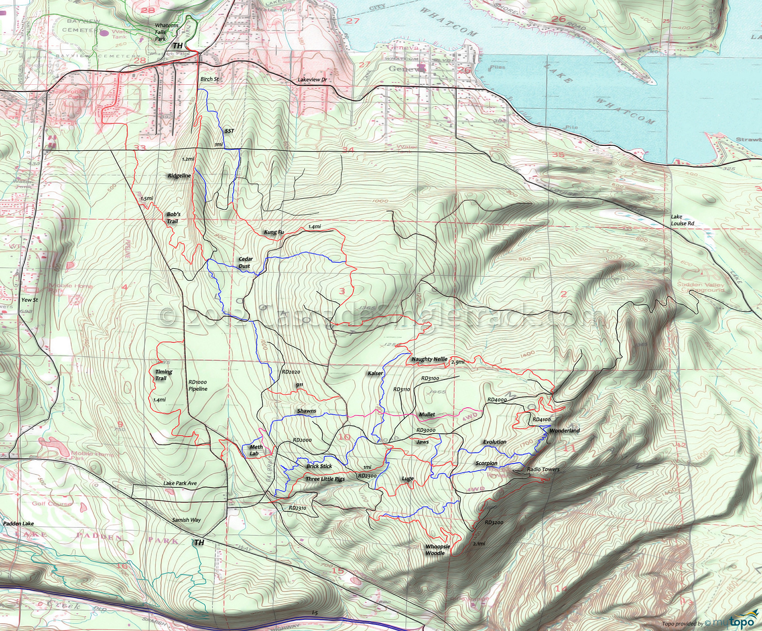
Galbraith Mountain Area Mountain Biking and Hiking Topo Map
Map includes: 911, Bob's, Brick Stick, Cedar Dust, Connector, Dans, Electric Avenue, Evolution, Flying Squirrel, Jaws, Kaiser, Kung Fu, Luge, Meth Lab, Mullet, Naughty Nellie, Scorpion, Not Shawn's, SST, Sht, Three Little Pigs, Timing, Tower, Wonderland, Whoopsie Woodle Mountain Biking and Hiking Trails.
TH: Ascend Galbraith Lane .6mi then go right onto singletrack which leads to Meth Lab. Ascend to RD2020, then dog leg left to Not Shawns and ascend to Mullet, crossing a spur road at 1.8mi.
2mi: Go left on Kaiser, then go right onto Naughty Nelly at 2.6mi and climb to the 4.6mi RD4100 Wonderland intersection and ride to the towers.
5.1mi: At the tower ride summit, descend RD3000 to Whoopsie Woodle, then descend to the RD2300 intersection.
7.4mi: Go right onto RD2300 and ride to Brick Stick at 7.9mi and go left, descending to RD2100 then RD2000 back to the TH.
Options: This is the general route but there are many, many little trails within the section covered by this loop, depending on ones desire to get airborne.
Draggable map: Map window adjusts to screen size and will respond to touch control. Use scrollbar for mouse control.
No Map? Browser settings and some browser extensions can prevent the maps from appearing. Please see Site Tech


