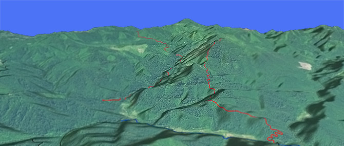
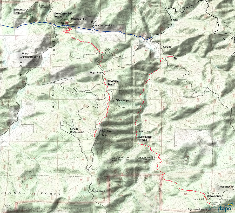
Cow Creek Tr1424

Overall: 4
Aerobic: 6
Technical: 5
Steepness: 5
Flow: 4
Singletrack: 100%
Multiple creek crossings and light use creates a challenging ride on the South Fork of Cow Creek.
Type
OAB
Length
Avg: 12.2mi
Ascent
Moderate
Elevation Change
TH:2500'
Avg Ascent:3100'
Ascent Incline
6%
Duration
Avg: 4hr
Weather
Forecast
NOAA
popup
USFS
This National Recreation Trail near Azalea Oregon follows Cow Creek through a dense stand of Douglas-fir and Western Hemlock, ascending the ridge to the Railroad Gap shelter and FR3232-911.
The trail crosses 5 creeks, up to 2 feet in depth and so should be avoided in the Spring.
The three-campsite Devils Flat CG is situated under a bluff and surrounded by a forest of cedar, pine, and madrone. The Gaurd Station is located on the south side of the CG.
Devil's Flat Tr1428 could be combined with Devil's Flat Tr1428 and the connecting forest roads, with more time spent on the road than trail.
Directions: I-5 Azalea exit #88, then go east on County Road #36 for 18mi to FR3232. Turn right onto FR3232 and continue 0.95mi to the TH. View Larger Map. No Map?.

OAB Directions
wet ride
- TH: Ride to the first South Fork Cow Creek crossing, with several other crossings in the first mile.
- 1.1mi: Ascend the hillside and traverse with several side-creek crossings until descending to the riverbed for the next South Fork crossing.
- 3.3mi: Cross South Fork and traverse the hillside to an overlook at 4.3mi, then descend and cross the drainage creek.
- 4.6mi: Begin the steep hillside traverse to Railroad Gap.
- 6.1mi: Return from Railroad Gap.
Trail Index
This Ride
Cow Creek Trail 1424
Hiking
Cow Creek Falls Trail 1422, Elk Skull Bluff Trail 1428A, Maranatha Trail 1422A
Campgrounds
Angel Camp, Devils Flat Campground
Trail Rankings
Ranking consistently applied to all of the listed trails.
- Overall Rating: Ride quality and challenge
- Aerobic: Ascent challenge
- Technical Difficulty: Terrain challenge
- Steepness: Average incline
- Flow: Uninterrupted riding
- Elevation Change: Total elevation gain
- Ride Difficulty: Terrain challenge


