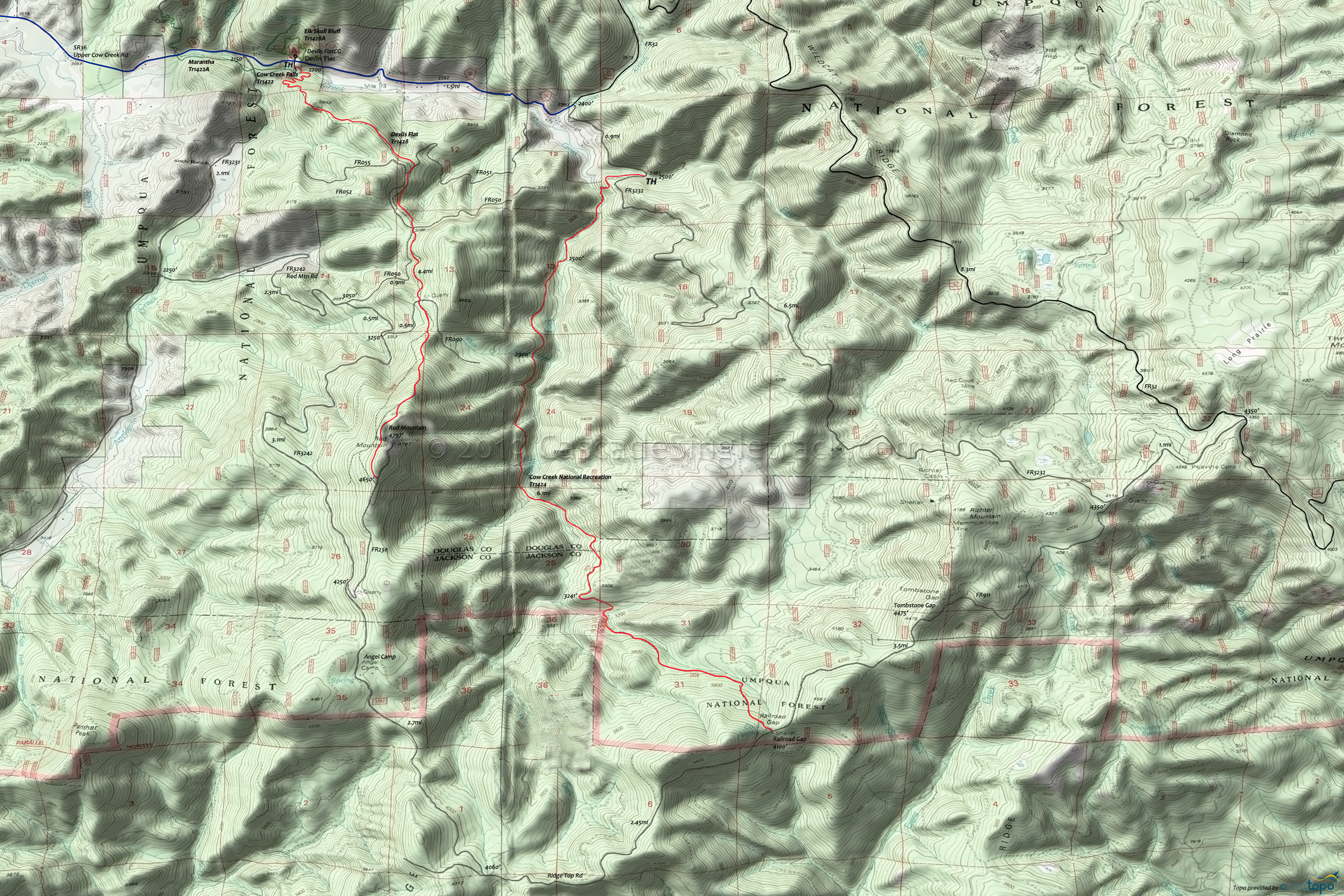
Cow Creek Trail 1424 Mountain Biking and Hiking Topo Map
Map includes: Cow Creek Falls Trail 1422, Cow Creek National Recreation Trail 1424, Devil's Flat Trail 1428, Elk Skull Bluff Trail 1428A, Maranatha Trail 1422A Mountain Biking and Hiking Trails.
TH: Ride to the first South Fork Cow Creek crossing, with several other crossings in the first mile.
1.1mi: Ascend the hillside and traverse with several side-creek crossings until descending to the riverbed for the next South Fork crossing.
3.3mi: Cross South Fork and traverse the hillside to an overlook at 4.3mi, then descend and cross the drainage creek.
4.6mi: Begin the steep hillside traverse to Railroad Gap.
6.1mi: Return from Railroad Gap.
Draggable map: Map window adjusts to screen size and will respond to touch control. Use scrollbar for mouse control.
No Map? Browser settings and some browser extensions can prevent the maps from appearing. Please see Site Tech


