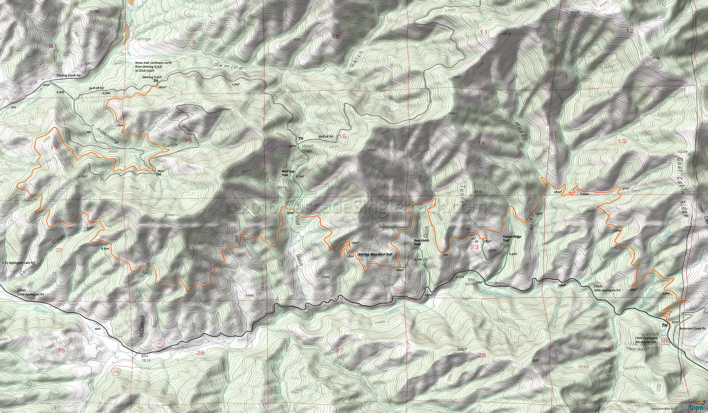
Sterling Mine Ditch Mountain Biking and Hiking Topo Map
Map Includes: Bear Gulch Trail, Sterling Mine Ditch Trail, Tunnel Ridge Trail, Wolf Gap Trail Mountain Bike and Hiking Trails.
TH: From the Little Applegate Recreation Site, ascend 1400' in 2.6mi to a Goat Cabin Ridge spur, followed by a descent to Muddy Gulch and on to the Tunnel Ridge Trail intersection.
5mi: Pass the Tunnel Ridge Trail intersection, then traverse Bear Gulch.
7mi: Pass the Bear Gulch Trail intersection and go through some switchbacks (few hundred feet ascent), then descend to Wolf Gulch.
9mi: Pass the Wolf Gap Trail intersection. Cross McCormick Gulch at 11.3mi, then the Cantrall Gulch drainage at 12mi.
15.5mi: Cross 39-2-17 Rd, cross Armstrong Gulch and continue on to the Deming Gulch TH.
17.2mi: At the Deming Gulch TH, return to the TH, shuttle, or return on the road.
Draggable map: Map window adjusts to screen size and will respond to touch control. Use scrollbar for mouse control.
No Map? Browser settings and some browser extensions can prevent the maps from appearing. Please see Site Tech


