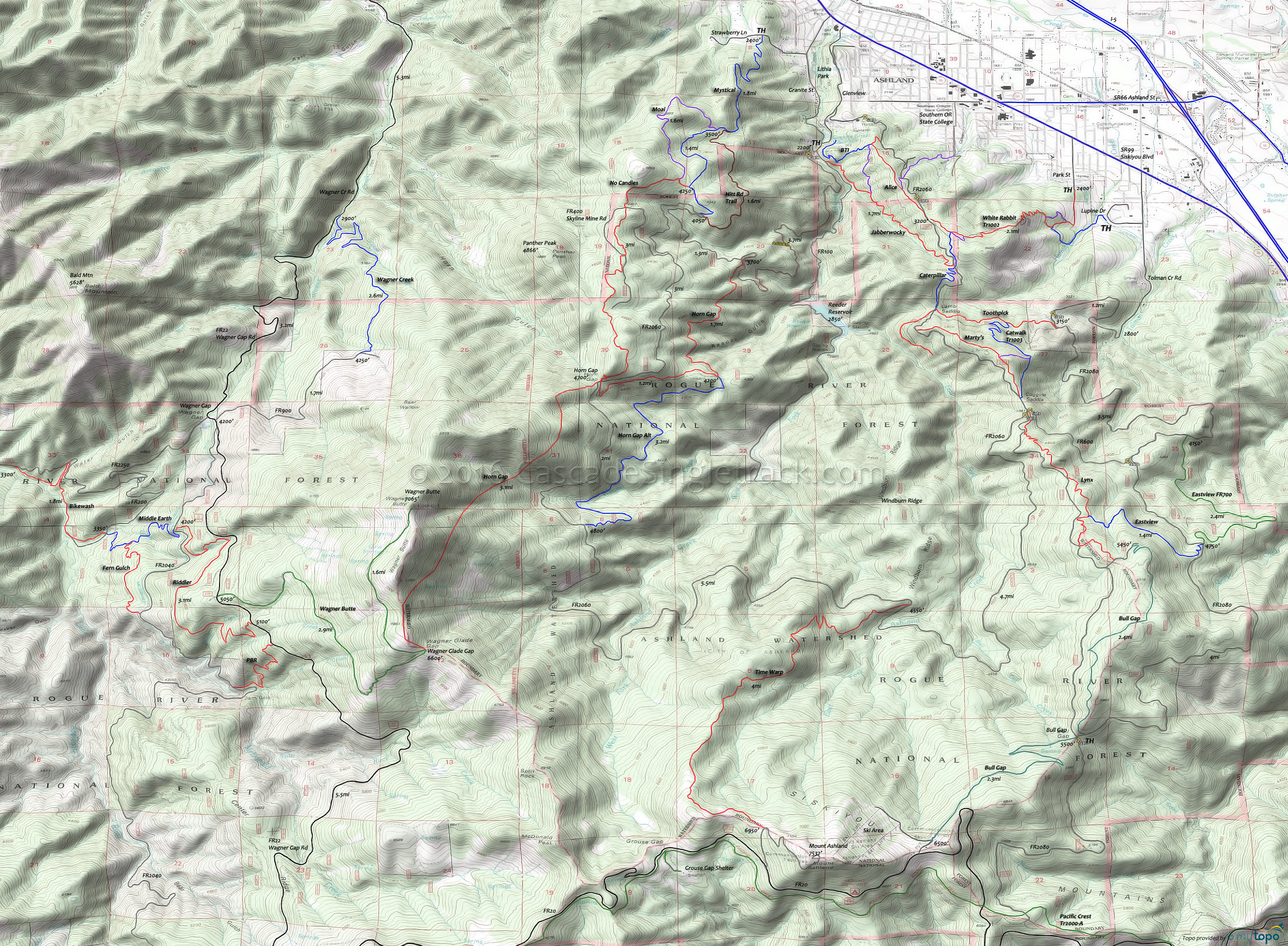
Ashland White Rabbit Mountain Biking and Hiking Topo Map
Map includes: White Rabbit Trail 1002, Caterpillar Trail 1004, Toothpick Trail, Catwalk Trail 1003, Lamb Mine Trail 1015, BTI Trail, Alice in Wonderland Trail, No Candies Trail, Horn Gap Trail 1014, Time Warp Trail, Bike Wash Trail, Hitt Road, Wagner Creek Trail, Eastview Trail 1012, Lynx Trail, Mystical Trail, Bull Gap Mountain Bike and Hiking Trails.
TH: From the Lupine Street TH, cross Hamilton Creek then pass the connector to the Park St TH. Ascend the sharp and steep switchbacks to a bench. Continue on to the 3way intersection with Caterpillar Tr1004 and the Queen of Hearts loop.
2.1mi: Go left on FR2060 Ashland Loop Rd and ascend to the FR200 intersection.
4.9mi: Go straight through the 5way intersection, onto FR200. Ascend to the FR270 Upper Lynx TH.
7.1mi: Go onto FR270 then onto Upper Lynx and descend the watershed boundary ridgeline, passing the Eastview Tr1012 intersection at 7.9mi.
9.5mi: Pass through the 5way intersection, continue north on FR2060 for 0.1mi, then go right onto Marty's. (Catwalk Tr1003 descends from this intersection).
10.8mi: Cross FR2060 onto Caterpillar Tr1004 and descend through the narrow switchbacks and across FR2060 to White Rabbit Tr1002.
12.4mi: Go right onto the Queen of Hearts loop then descend White Rabbit Tr1002 to the TH.
Draggable map: Map window adjusts to screen size and will respond to touch control. Use scrollbar for mouse control.
No Map? Browser settings and some browser extensions can prevent the maps from appearing. Please see Site Tech


