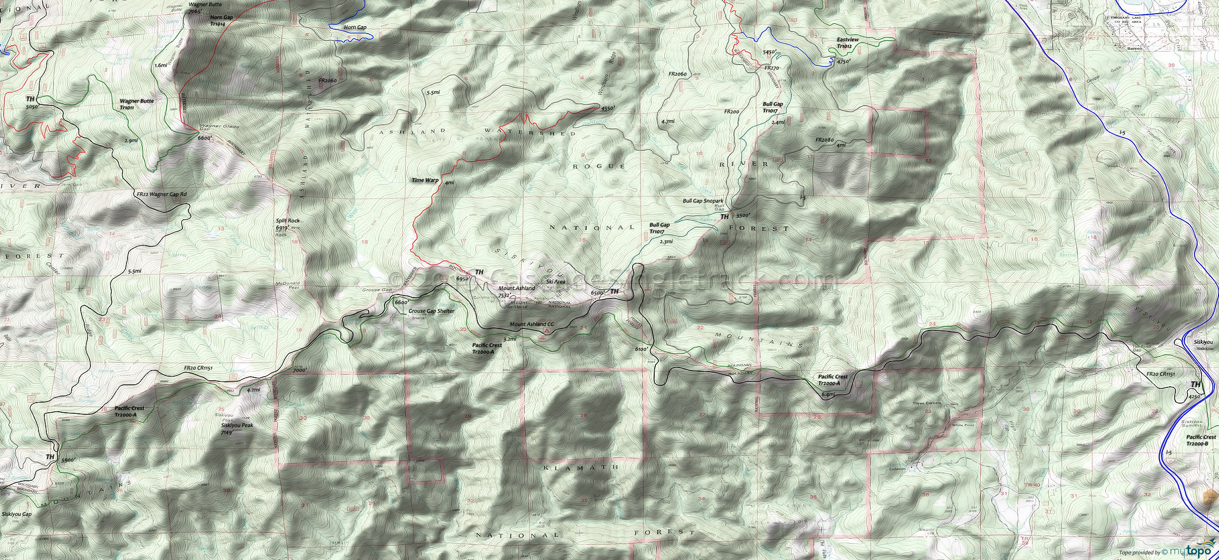
Pacific Crest Tr2000-A Mountain Biking and Hiking Topo Map
Map includes: Pacific Crest Trail 2000-A, Bull Gap Trail 1017, Time Warp Trail, Mount Ashland Trails, Wagner Butte Trail, Grouse Gap Trail Hiking Trails.
Parallel to FR20 and with several easily accessible TH along the way. Consider a shuttle from Mount Ashland or Siskiyou Gap.
Draggable map: Map window adjusts to screen size and will respond to touch control. Use scrollbar for mouse control.
No Map? Browser settings and some browser extensions can prevent the maps from appearing. Please see Site Tech


