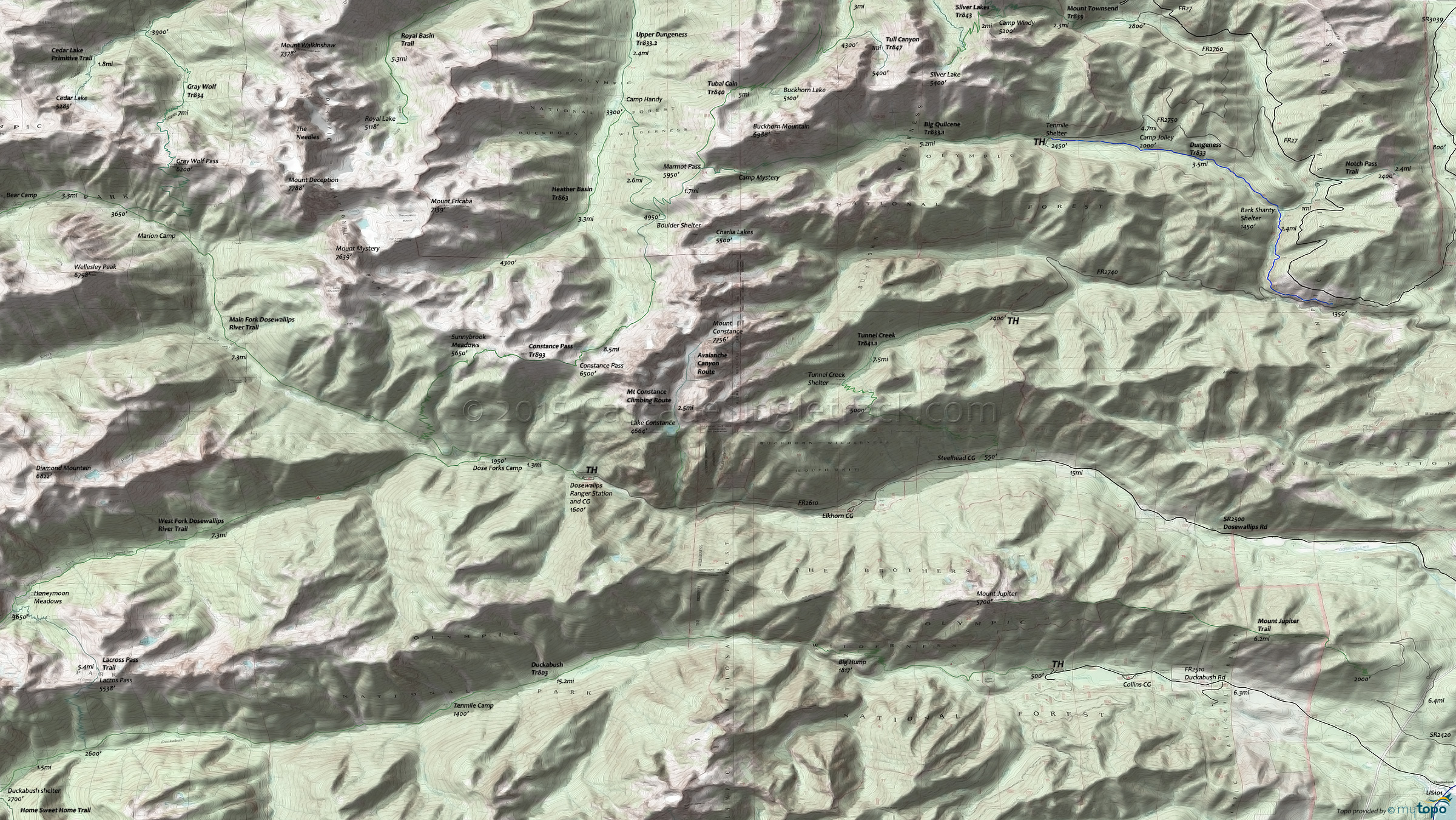
Duckabush Trail 803 and Main Fork Dosewallips River Trail Area Hiking Topo Map
Map includes: Big Quilcene Trail 833.1, Constance Pass Trail 893, Duckabush Trail 803, Dungeness Trail 833, Heather Basin Trail 863, Main Fork Dosewallips River Trail, Notch Pass Trail, Tubal Cain Trail 840, Tunnel Creek Trail 841.1 Hiking Trails.
Main Fork Dosewallips River Trail steadily ascends from 2000' to 4500'. Check conditions, as at last check the Dosewallips Road was washed-out 5.5mi from TH.
The 17mi (5400' ascent) Duckabush River Tr803 is an easy grade for 2.4mi, with a steep and technical section while ascending Big Hump. Five Mile, Ten Mile and Upper Duckabush camp sites are along the way to O'Neil Pass Trail.
Draggable map: Map window adjusts to screen size and will respond to touch control. Use scrollbar for mouse control.
No Map? Browser settings and some browser extensions can prevent the maps from appearing. Please see Site Tech


