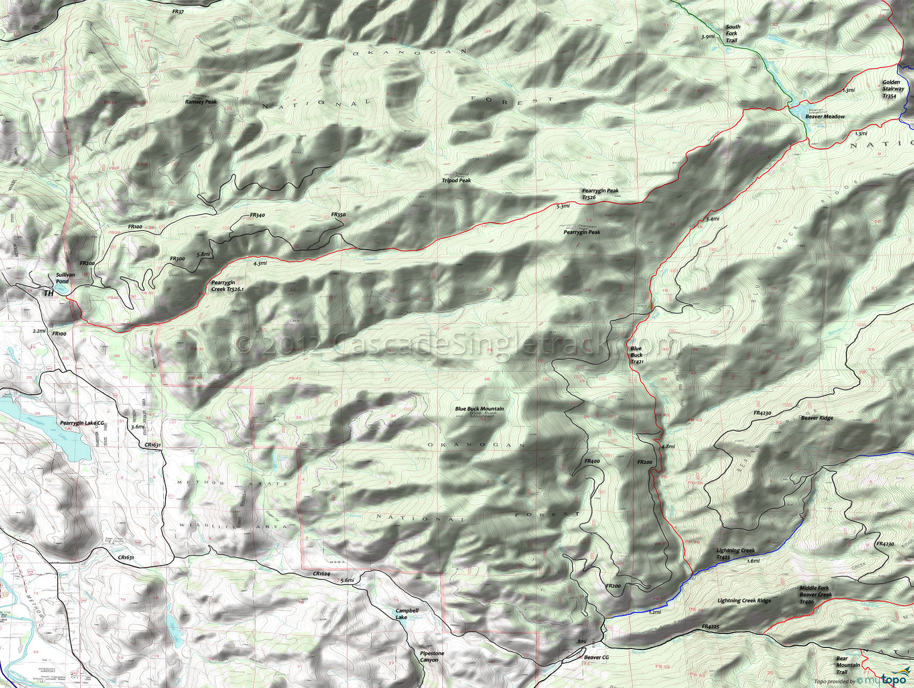
Pearrygin Creek Trail 526.1 and Pearrygin Ridge Trail 526 Area Mountain Biking and Hiking Topo Map
Map includes: Blue Buck Trail 421, Lightning Creek Trail 425, Pearrygin Creek Trail 526.1, Pearrygin Ridge Trail 526 Mountain Biking and Hiking Trails.
TH: Climb FR100 past the intersection with FR200, then climb FR300 to the Pearrygin Ridge Tr526 TH.
6.2mi: Climb Pearrygin Ridge Tr526 to Golden Stairway Tr354.
13.2mi: Go right on Golden Stairway Tr354.
14mi: Go right on Blue Buck Tr421.
15.3mi: Go right on South Fork Trail.
15.8mi: Go left on Pearrygin Ridge Tr526, returning to FR300.
21.4mi: About 0.5mi on FR300, go left onto Pearrygin Creek Tr526.1. (TH is across the road from the watering tank)
25mi: Go right and climb the steep cattle trail when you reach the barbed wire gates. This trail and some doubletrack leads back to Sullivans pond.
Draggable map: Map window adjusts to screen size and will respond to touch control. Use scrollbar for mouse control.
No Map? Browser settings and some browser extensions can prevent the maps from appearing. Please see Site Tech


