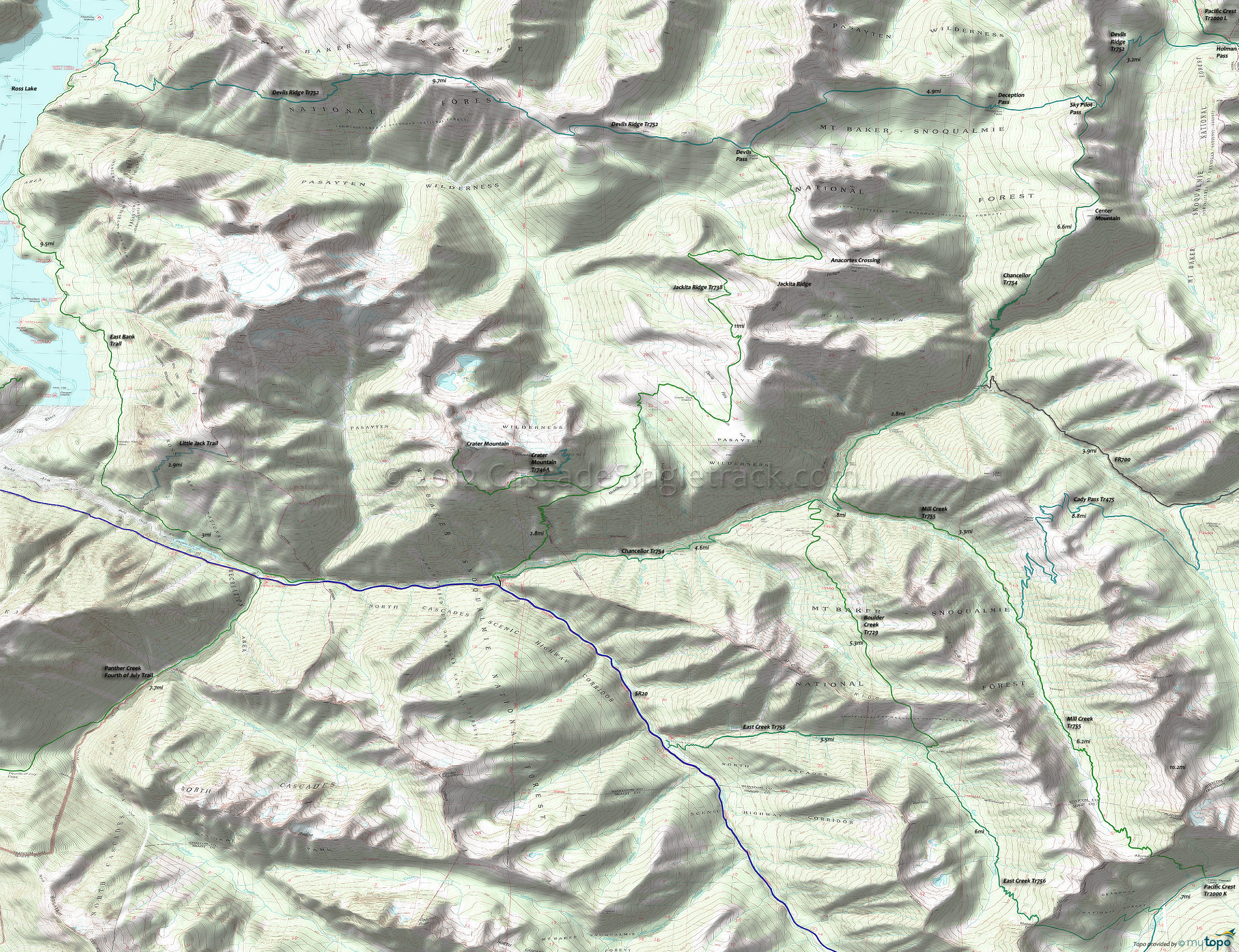
East Creek Trail, Jackita Ridge Trail and Pacific Crest Trail Area Hiking Topo Map
Twitter Search
#PacificCrestTrail
Map includes: Boulder Creek Trail 729, Cady Pass Trail 475, Devils Ridge Trail 752, East Bank Trail, East Creek Trail 756, Jackita Ridge Trail 738, Mill Creek Trail 755, Pacific Crest Trail 2000-L Hiking Trails.
Area Hiking: The area topo map shows the area wilderness hiking trails north of West Fork Methow River Tr480 to Boundary Tr533. The area west to Ross Lake contains numerous popular loop options for the adventurous hiker.
From the SR20 Four Mile CG, East Creek Tr756 ascends the East Creek drainage, passing Boulder Creek Tr729 and the Gold Hill Mine at 3.5mi. The trail beyond this point is not maintained or much used and crosses the ridgeline at MeBee Pass before merging with Pacific Crest Tr2000.
From the SR20 Canyon Creek TH, Jackita Ridge Tr738 extends north to Devils Ridge Tr752, through McMillan Park and Devils Park before traversing below the Jackita Ridgeline. Crater Tr746 provides a spur to Crater Mountain and the Jerry Glacier.
West Fork Pasayten Tr472 and Robinson Creek Tr478 circumnavigate Pasayten Peak, Gold Ridge and Buckskin Ridge before merging at the Pasayten River just south of the Pasayten Guard Station.
Draggable map: Map window adjusts to screen size and will respond to touch control. Use scrollbar for mouse control.
No Map? Browser settings and some browser extensions can prevent the maps from appearing. Please see Site Tech


