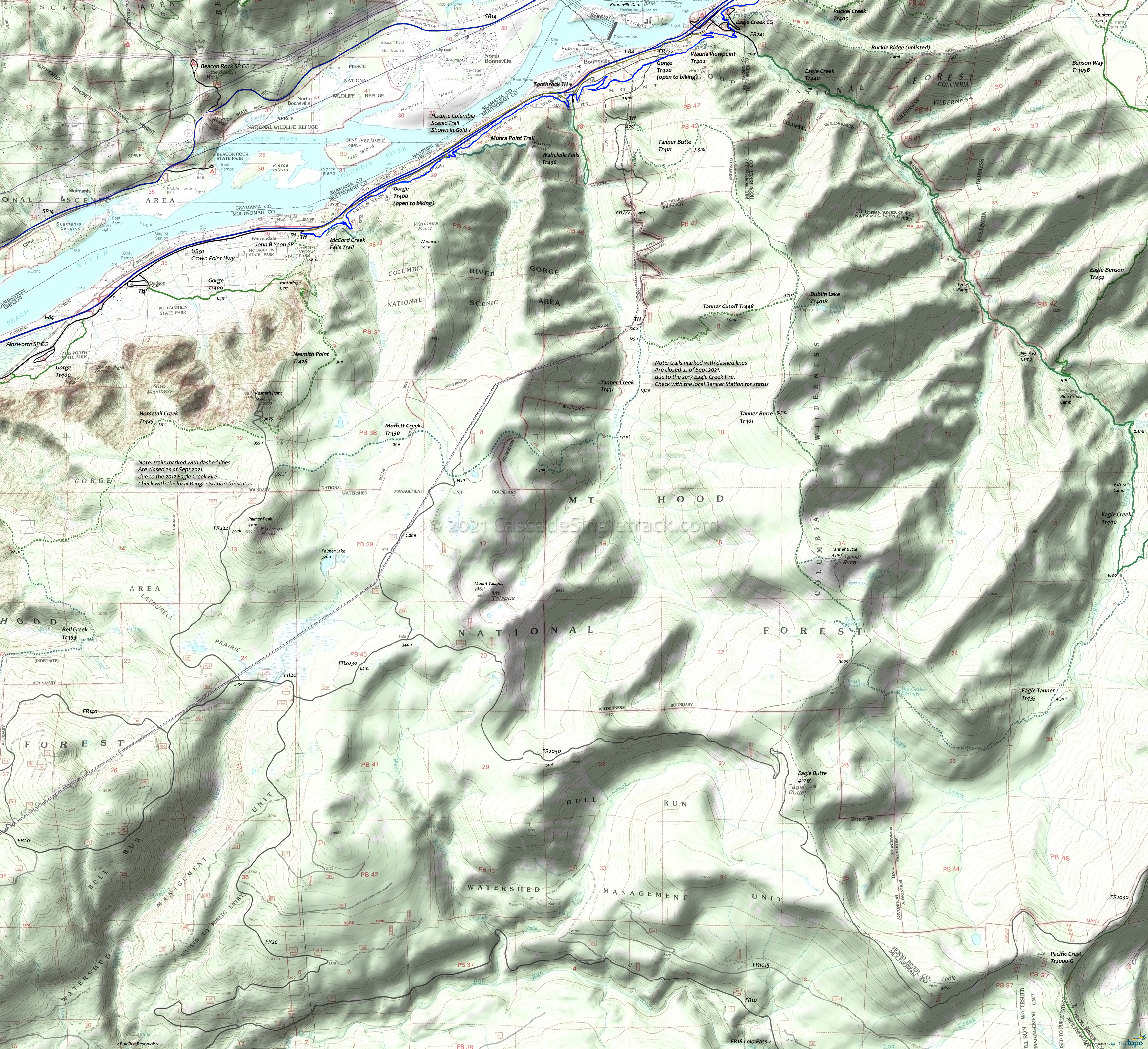
Columbia River Gorge Hiking Topo Map
Twitter Search
#ColumbiaRiverGorge
This Columbia River Gorge National Scenic Area hiking map includes Bell Creek Trail 459, Devils Rest Trail 420C, Dublin Lake Trail 401B, Gorge Trail 400, Horsetail Creek Trail 425, Moffett Creek Trail 430, McCord Creek Falls Trail, Munra Point Trail, Nesmith Point Trail 428, Tanner Butte Trail 401, Tanner Creek Trail 431, Tanner Cutoff Trail 448, Wahclella Falls Trail 436, Wahkeena Trail 420 and Wauna Viewpoint Trail 402.
Most of these trails extend into the Mount Hood Wilderness area, as the Columbia River Gorge National Scenic Area boundary does not extend inland more than a few miles and mostly consists of the immediate gorge area.
2017 Eagle Creek Fire: The middle portion of the Columbia River Gorge trail system was damaged by the fires. See the Mount Hood NF Site for closures.
Draggable map: Map window adjusts to screen size and will respond to touch control. Use scrollbar for mouse control.
No Map? Browser settings and some browser extensions can prevent the maps from appearing. Please see Site Tech


