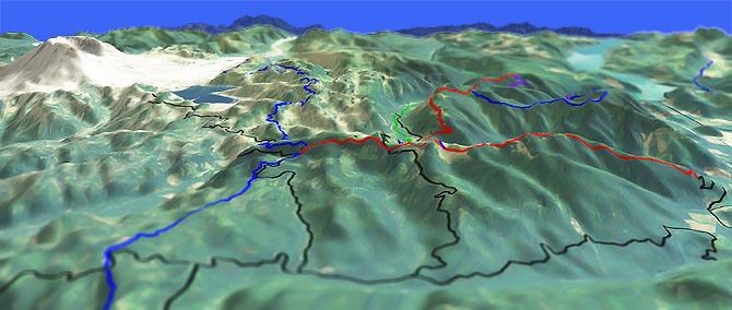
Strawberry Mountain Tr220

Overall: 8
Aerobic: 6
Technical: 6
Steepness: 7
Flow: 8
Singletrack: 100%
Unlike most ridgeline trails, Strawberry Mt Tr220 offers many trailhead starting-point options.
Type
OAB
Length
Avg: 13mi
Ascent
Intense
Elevation Change
TH:3250'
Avg Ascent:4700'
Ascent Incline
13%
Duration
Avg: 3hr
Weather
Forecast
NOAA
popup
USFS
Trail
Review
A common ride is also the least appealing, starting from the northern TH and riding the full length of the trail.
This involves accessing the trail from private land on a rough road, then crawling 2.7mi over an unrelenting 19% grade, creating a 17.8mi ride with 7100' climbing.
For those not seeking such punishment, starting from Green Rvr Tr213 and riding to Strawberry Mountain creates something much more reasonable, so this is the route covered on this page.
An easier option is to use FR2516 or FR074 to access the mid point of the trail, avoiding almost all of the climbing.
This creates a very moderate 8.4mi ride with 2600' elevation gain, mostly consisting of undulating ridgeline terrain.
As a side trip, the Strawberry Mountain fire lookout spur trail is .25mi south of the FR2516 intersection, with a great view of Saint Helens.
Combining Strawberry Mt Tr220 with Boundary Tr1 (from Norway Pass) creates a nearly epic 21mi ride, with 6800' of climbing and a 10% ascent grade on portions of the Boundary Tr1 section and at the southern end of Strawberry Mt Tr220.
Starting from Boundary Tr1 at Elk Pass would provide a slightly easier approach to the southern Strawberry Mt Tr220 TH.
An easy shuttle option would be Green River Tr213 to Boundary Tr1 at Elk Pass.
The Ryan Lake area is also a good camping choice, offering easy access to Strawberry Mt Tr220, Goat Mt Tr217 and Green River Tr213.
Directions: To the Goat Mt TH: FR26 to Norway Pass then to Ryan Lake. TH is about 1500ft west of FR26. View Larger Map. No Map?.

OAB Directions
green strawberry
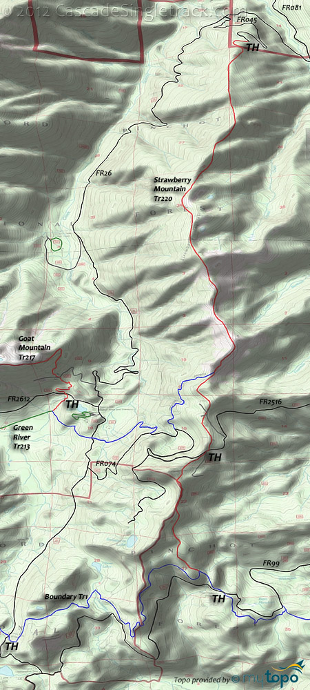
Strawberry Mountain Area Topo Map
- TH: Start from either the Ryan Lake campground or from the Goat Mt Tr217 TH, riding downhill to Green River Tr213. Go left and cross FR26 then ascent the side of Strawberry Mountain.
- 3.7mi: Go left onto Strawberry Mt Tr220 and climb to the summit. Note: The ride can be extended by riding south, with about 2.5mi of undulating ridgeline terrain before Strawberry Mt Tr220 descends to Boundary Tr1.
- 5.4mi: Reach the summit, after which the trail drops down the ridge and into the woods.
- 6.6mi: Turn around point, beyond which the trail descends sharply to the northern TH.
Trail Index
This Ride
Boundary Trail 1, Strawberry Mtn Trail 220
Area
Wilderness
XC Ski
Campgrounds
Iron Creek Campground, Tower Rock Campground
Trail Rankings
Ranking consistently applied to all of the listed trails.
- Overall Rating: Ride quality and challenge
- Aerobic: Ascent challenge
- Technical Difficulty: Terrain challenge
- Steepness: Average incline
- Flow: Uninterrupted riding
- Elevation Change: Total elevation gain
- Ride Difficulty: Terrain challenge


