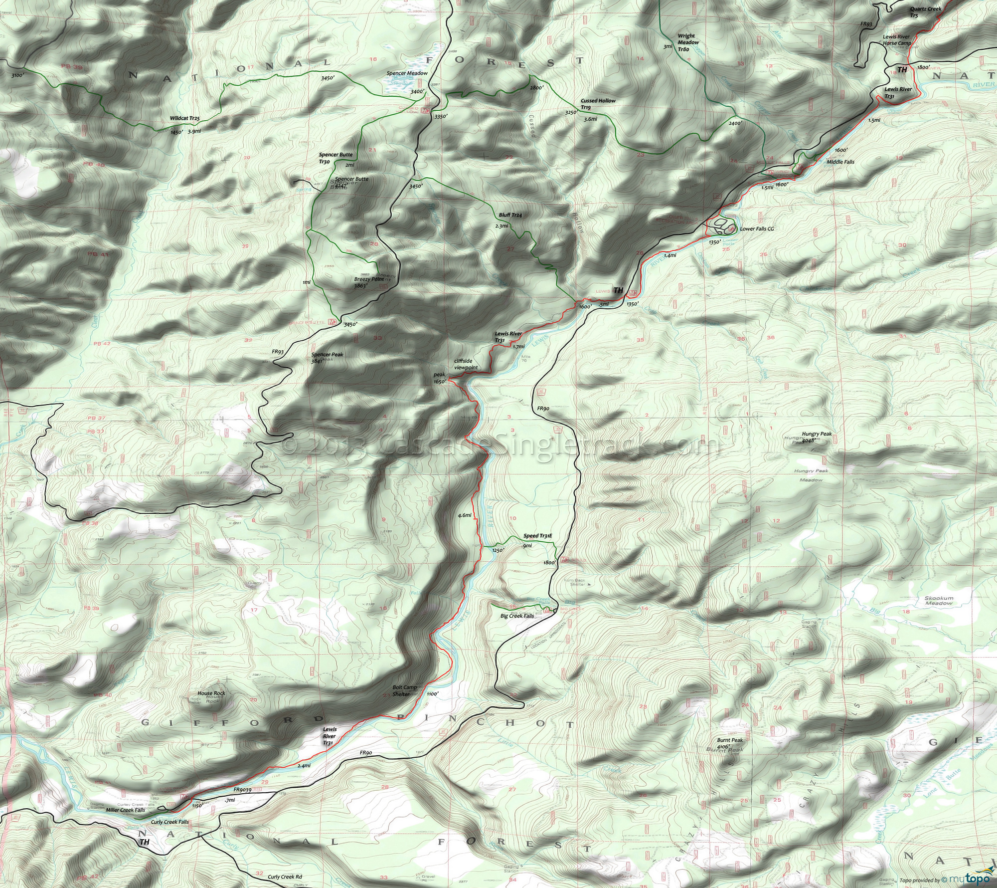
Lewis River Trail 31 Area Mountain Biking and Hiking Topo Map
Map includes: Bluff Trail 24, Cussed Hollow Trail 19, Lewis River Trail 31, Spencer Butte Trail 30, Wildcat Trail 25 and Wright Meadow Trail 80 Mountain Biking and Hiking Trails.
TH: From the FR9039 parking area, ride across the bridge and join the trail on the right side of the road.
5.4mi: Having passed the Bolt Camp Shelter and the fastest section of the trail, go past the intersection with Speed Tr31E (which accesses FR90 but requires fording the river and may not be well maintained due to lack of use). Terrain becomes more intense, with short hillside climbs and detours due to washouts.
7.8mi: The end of the steepest climbing, culminating in a 1mi section that most will have to hike.
9.2mi: Some fast riding through dense forest to the Cussed Hollow Tr19 TH, then cross FR90 at 9.7mi. Pass the Lower Falls Recreation Area at 10.9mi.
12mi: After some climbing, reach the Wright Meadows Tr80/Bluff Tr24 TH and some local Middle Falls trails, then resume climbing to the upper TH, at FR90. Turn around and head back, or continue on to Quartz Creek Tr5.
Draggable map: Map window adjusts to screen size and will respond to touch control. Use scrollbar for mouse control.
No Map? Browser settings and some browser extensions can prevent the maps from appearing. Please see Site Tech


