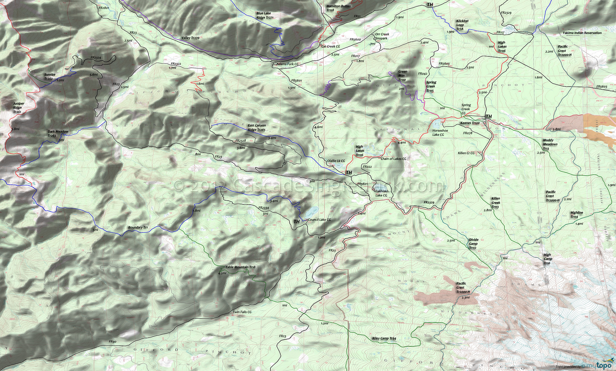
High Lakes Trail Area Mountain Biking and Hiking Topo Map
Twitter Search
#PacificCrestTrail
Map includes Divide Camp Trail 112, East Canyon Ridge Trail 265, Green Mountain Trail 110, High Lakes Trail 116, Keenes Trail 120, Killen Creek Trail 113, Muddy Meadows Trail 13, Pacific Crest Trail 2000-H and Spring Creek Trail 115 Mountain Biking and Hiking Trails.
TH: Ride out to Chain of Lakes then descend 900' over 1.5mi to Adams Creek. This is the steepest section of this ride.
2.9mi: Ascend from Adams Creek to Horseshoe Lake, climbing 490' over 1.5mi. Pass the Spring Cr Tr115 TH at 4.2mi, the Keenes Tr120 at 4.8mi and Keenes Connector Tr120A at 4.9mi. Go left on Keenes Tr120, then left on Spring Cr Tr115 to create a CW lollipop ride.
7.5mi: After riding across relatively flat terrain, cross FR5603 and continue to the intersection with Klickitat Loop Tr7A and FR117.
8.3mi: At the FR117 intersection, turn around for the return ride to the TH, or go right on FR117 to FR2329, then go right to another section of Klickitat Loop Tr7A and ride to the Goat Rocks Wilderness boundary. Another section of Klickitat Loop Tr7A can be found by going left at FR117, but that trail descends sharply to FR5600 and so is not suitable for a High Lakes Tr116 OAB ride.
Mount Adams Wilderness hiking: Muddy Meadows Tr13 ascends to the northern flank of Mount Adams through timber and small meadows, crossing PCT at 2.7mi.
The meadow area was used by Native Americans as a summer berry camp. In the 1800s, many berry camps were located on the north and northwest sides of Mount Adams, with berry-drying trenches in the area. The trail terminates at Highline Tr114, which circumnavigates the northern flank of Mount Adams.
To the east, Highline Tr114 crosses glacial meltwater streams that form two branches of the Muddy Fork, which can be hazardous during Spring runoff. The trail is restricted to permit-use as it continues into the Yakima Indian Reservation.
Killen Creek Tr113 was originally a Native American trail used to access berry-picking areas, and leads to High Camp Tr10, which is the access trail to ascend the Mount Adams North Cleaver Route. There is a historical cabin site 2mi from the Killen Creek Tr113 TH, which should not be disturbed.
Draggable map: Map window adjusts to screen size and will respond to touch control. Use scrollbar for mouse control.
No Map? Browser settings and some browser extensions can prevent the maps from appearing. Please see Site Tech


