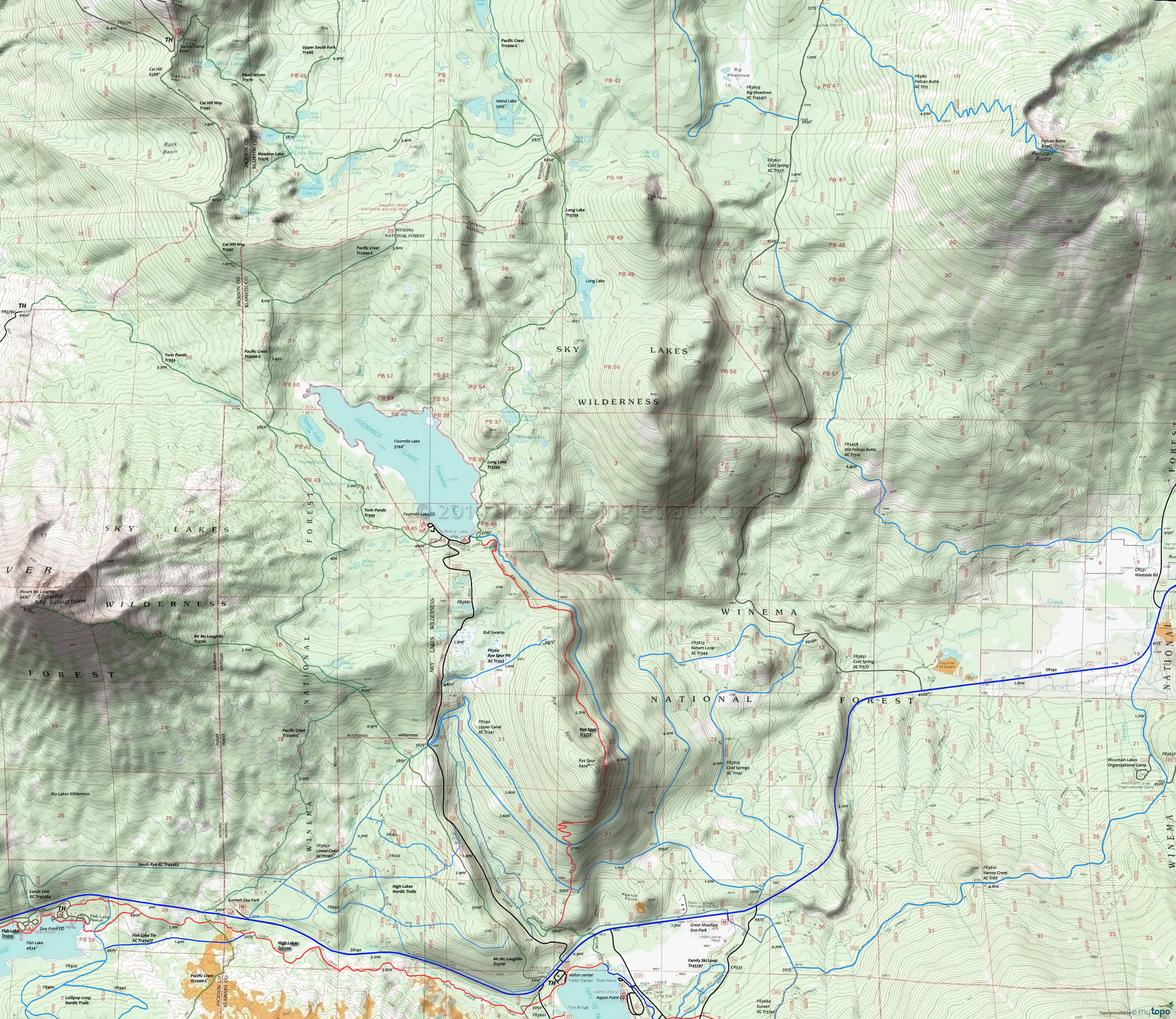
Rye Spur Trail Area Mountain Biking and Hiking Topo Map
Twitter Search
#PacificCrestTrail
Map includes: Long Lake Trail 3759, Mount McLoughlin Trail 3716, Mountain Lakes Trail 3721, Pacific Crest Trail 2000-C, Rye Spur Trail 3771 Mountain Biking and Hiking Trails.
TH: Cross SR140 and FR550 then use .7mi of Nature Tr3735 to access Rye Spur Tr3771. Steep ascent to the top of Rye Spur, crossing FR3633 at 1.2mi and Upper Canal Tr241 at 1.8mi.
3.2mi: Crest the Rye Spur summit, having ascended 1450'. Relatively flat riding to Fourmile Lake, paralleling Cascade Canal.
6.4mi: Fourmile Lake.
Draggable map: Map window adjusts to screen size and will respond to touch control. Use scrollbar for mouse control.
No Map? Browser settings and some browser extensions can prevent the maps from appearing. Please see Site Tech


