Tumalo Creek and Tumalo Ridge Trail Area Mountain Biking and Hiking Topo Map
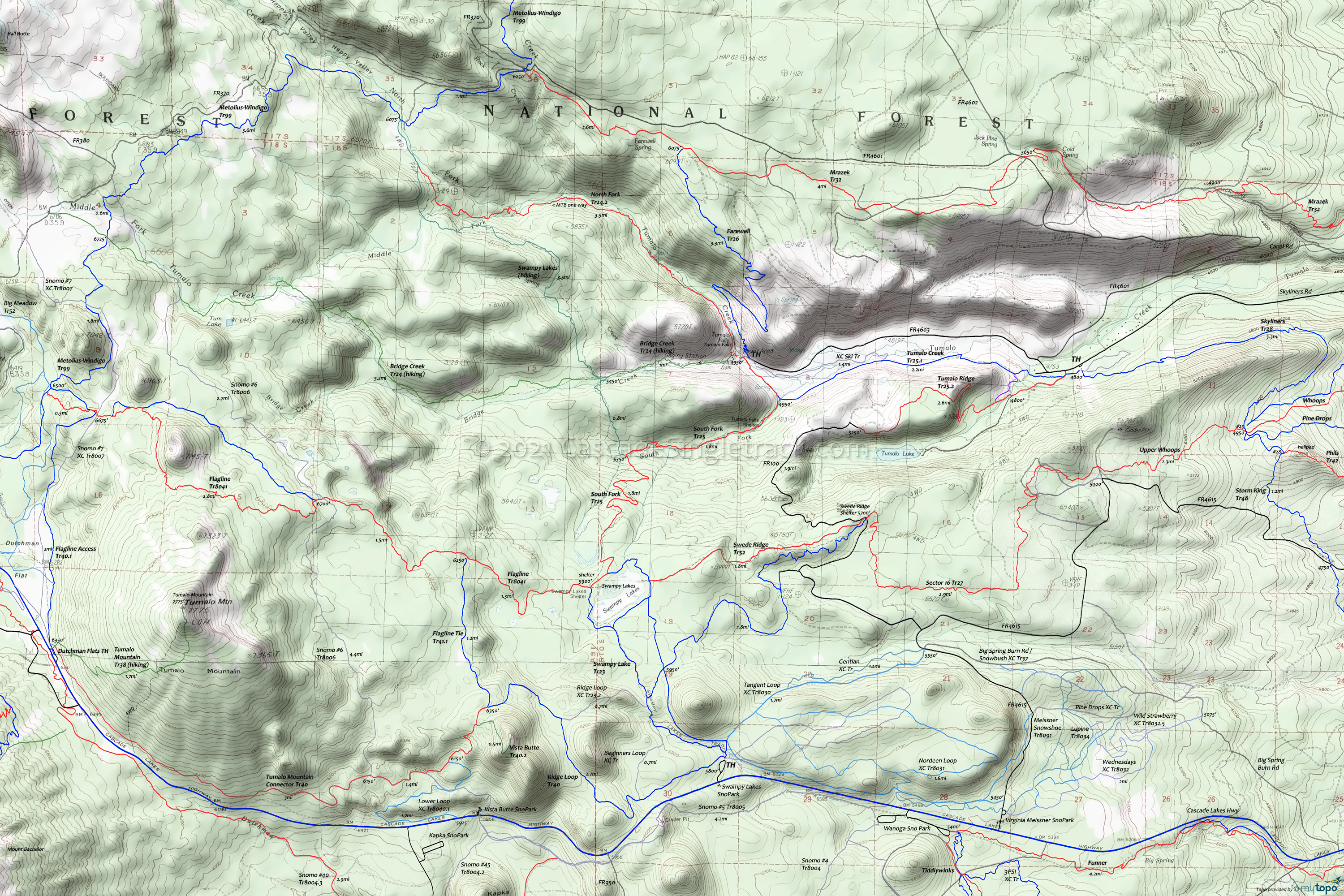
Map includes Flagline Trail 41, Metolius-Windigo Trail 99, North Fork Trail 24.2, South Fork Trail 25, Swampy Lake Trail 23, Swede Ridge Trail 52, Tumalo Creek Trail 25.1 and Tumalo Ridge Trail 25.2 Mountain Biking and Hiking Trails.
This very popular 12.5mi (2000' ascent) moderate 2.5hr ride which is about as challenging as the Tumalo Creek Tr25.1 to North Fork Tr24.2 ride.
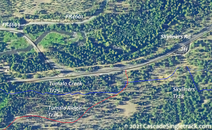
TH: The ride starts at the FR430 intersection (FR430 goes to Tumalo Lake). It's easy to head in the wrong direction from the Skyliners Sno-Park TH
View of the Skyliners Sno-Park TH, so check the map or ask a rider. Go right and follow the doubletrack for 1.3mi. Bear left at the fork and the trail turns to singletrack. Expect hikers on this easily accessed trail section.
2.3mi: Cross the south fork of the Tumalo Creek then go left onto South Fork Tr25 and ascend to Swampy Lake Tr23. 
3.8mi: At the Bridge Creek Tr24 intersection, bear left on South Fork Tr25 and complete the Swampy Lake ascent, with some switchbacks leading past a small crescent lake. Go left at the 5.6mi Swampy Loop Tr23.2 fork (near the Swampy Lakes shelter) and ride across the northern side of Swampy Lakes, then at 6mi go left at the Swede Ridge Tr52 intersection.
14mi: Swede Ridge Tr52 ends at FR100, at the intersection with Sector 16 Tr27. Go left onto FR100 (towards the Swede Ridge shelter).
7.9mi: Go right onto the second doubletrack on the right, then go then right onto Tumalo Ridge Tr25.2. Ride to the edge of the ridge at 9.8mi, then descend the steep ridge side.
12.1mi: Bear right at the fork and head back to the TH.
Draggable map: Map window adjusts to screen size and will respond to touch control. Use scrollbar for mouse control.
No Map? Browser settings and some browser extensions can prevent the maps from appearing. Please see Site Tech


