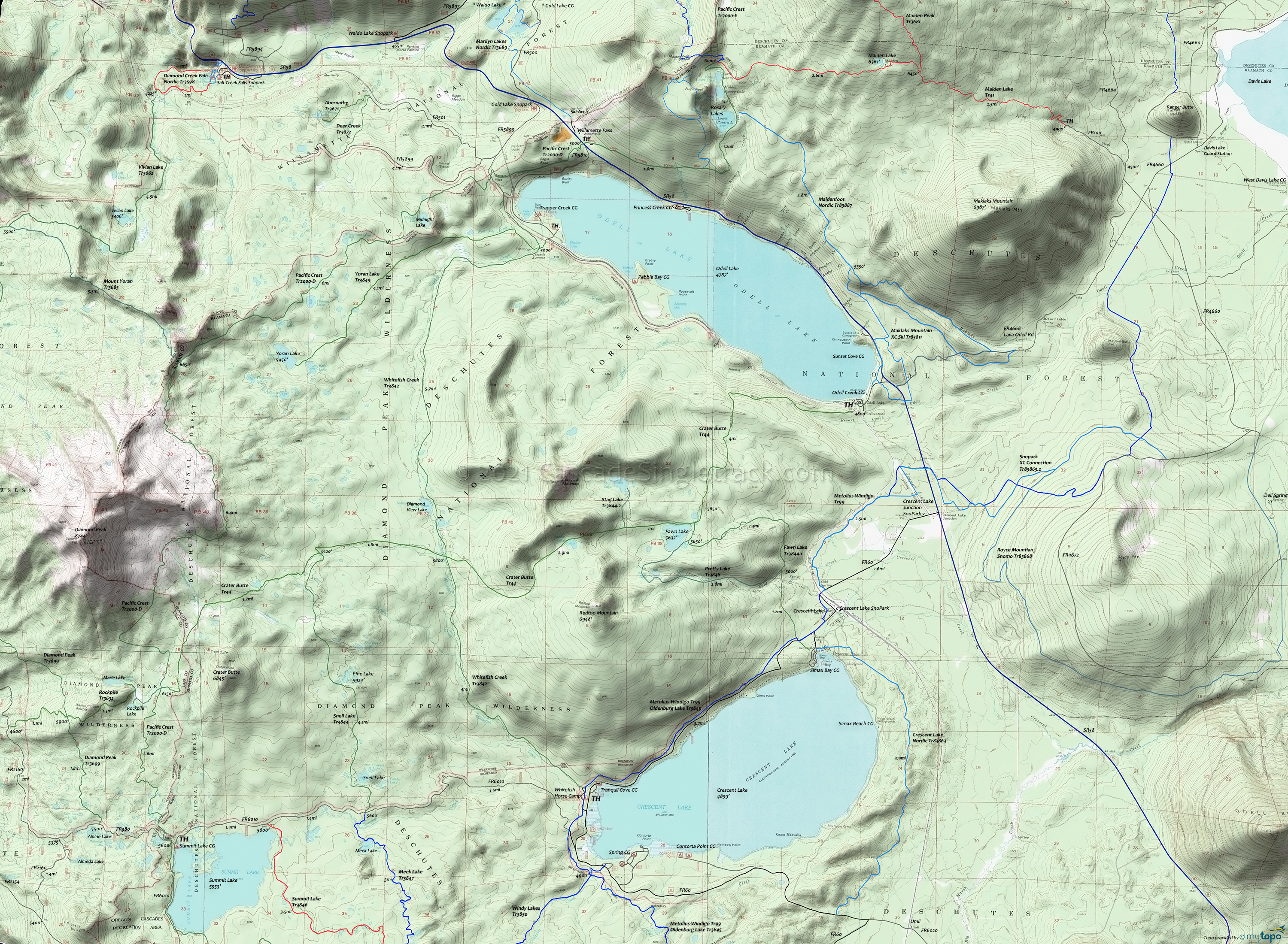
Diamond Peak Wilderness Area Hiking Topo Map
Twitter Search
#PacificCrestTrail
Map includes Crater Butte Trail 44, Fawn Lake Trail 3844.1, Pacific Crest Trail 2000-D, Pretty Lake Trail 3848, Snell Lake Trail 3843, Stag Lake Trail 3844.2, Whitefish Creek Trail 3842, Yoran Lake Trail 3849 Hiking Trails.
Whitefish Creek Trail 3842 begins at west end of Crescent Lake and follows Whitefish Creek through lodgepole pine to a view of Diamond Peak at Diamond View Lake, then descends along Trapper Creek through Engelmann spruce and white fir to the west end of Odell Lake.
Yoran Lake Trail 3849 begins at west end of Odell Lake and ends at Yoran Lake, gradually ascending through a forest of Engelmann spruce, silver fir and noble fir. At 1mi the trail passes through a wet meadow then continues to a mountain hemlock/white fir forest with small openings near the lakes.
Wilderness Permits are required for both day-use and overnight travel in the Wilderness from Memorial Day Weekend until Oct 31, and are available at the trailhead.
The Odell Lake area has some XC Ski trails, including Maklaks Mountain XC Trail 83811 and the Royce Mountain doubletrack. Also check out the Sno Parks near South Waldo Lake.
Draggable map: Map window adjusts to screen size and will respond to touch control. Use scrollbar for mouse control.
No Map? Browser settings and some browser extensions can prevent the maps from appearing. Please see Site Tech


