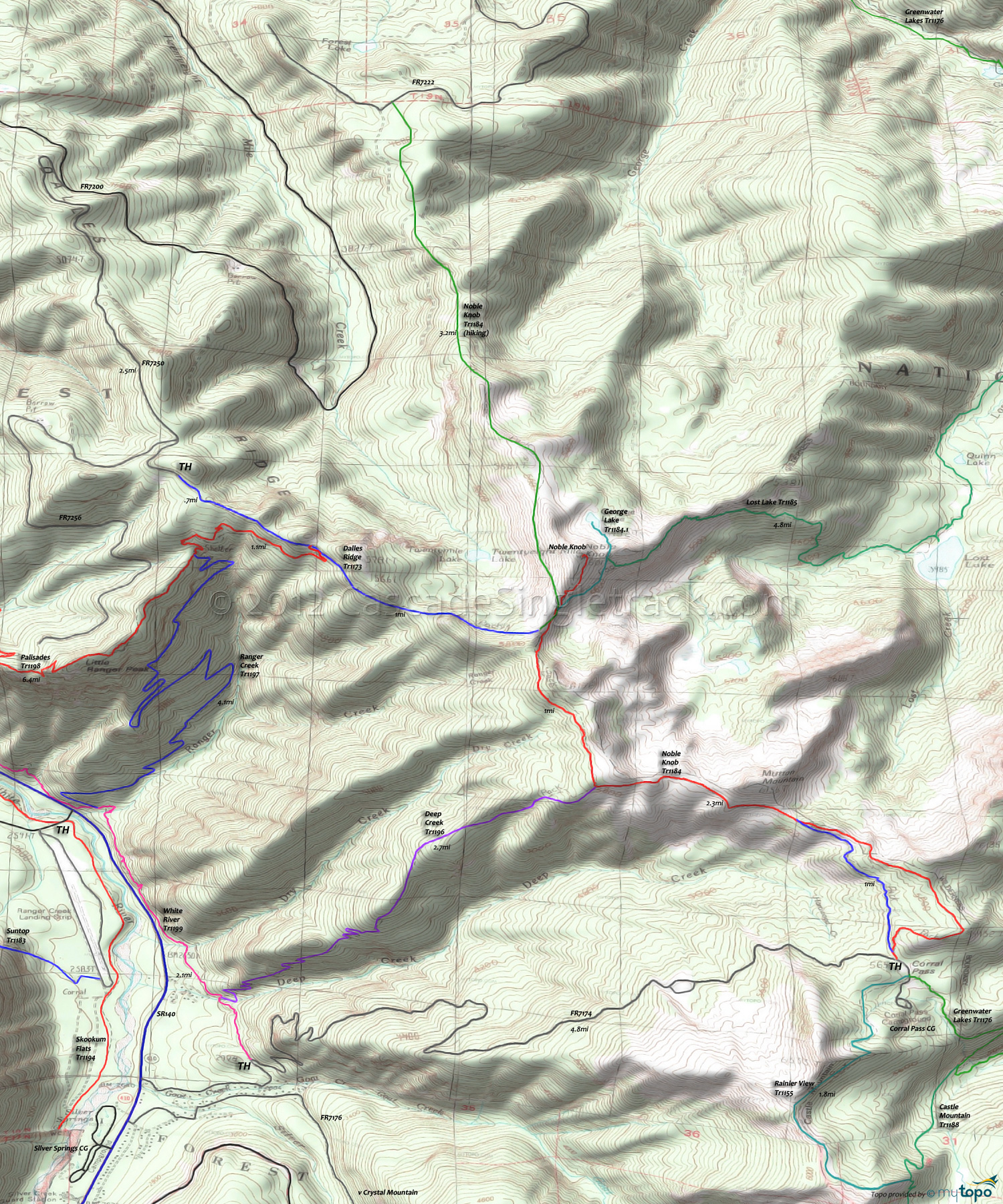
Dalles Ridge Trail 1173 and Noble Knob Trail 1184 Area Mountain Biking and Hiking Topo Map
Map includes Dalles Ridge Trail 1173, Deep Creek Trail 1196, Noble Knob Trail 1184, Palisades Trail 1198 and Ranger Creek Trail 1197 Mountain Biking and Hiking Trails.
TH: Steady climb from the Dalles Ridge TH to Noble Knob peak, passing Ranger Creek Tr1197 TH at .7mi and merging with Noble Knob Tr1184 for the summit ascent. This is the highest elevation of the ride (5950') and Noble Knob Tr1184 defines the edge of the Norse Peak wilderness so do not take any trails to the left (North).
2.6mi: Ride another mile north on Noble Knob Tr1184 (before it descends to the northern TH), or just head East towards Corral Pass.
3.7mi: Pass the Deep Cr Tr1196 intersection at 3.7mi, then pass Mutton Mt at 4.6mi.
6mi: Reach the Coral Pass campground. Turn around, then go right at the T and ride on to Mutton Mountain, then back to the Dalles Ridge Tr1173 TH.
Draggable map: Map window adjusts to screen size and will respond to touch control. Use scrollbar for mouse control.
No Map? Browser settings and some browser extensions can prevent the maps from appearing. Please see Site Tech


