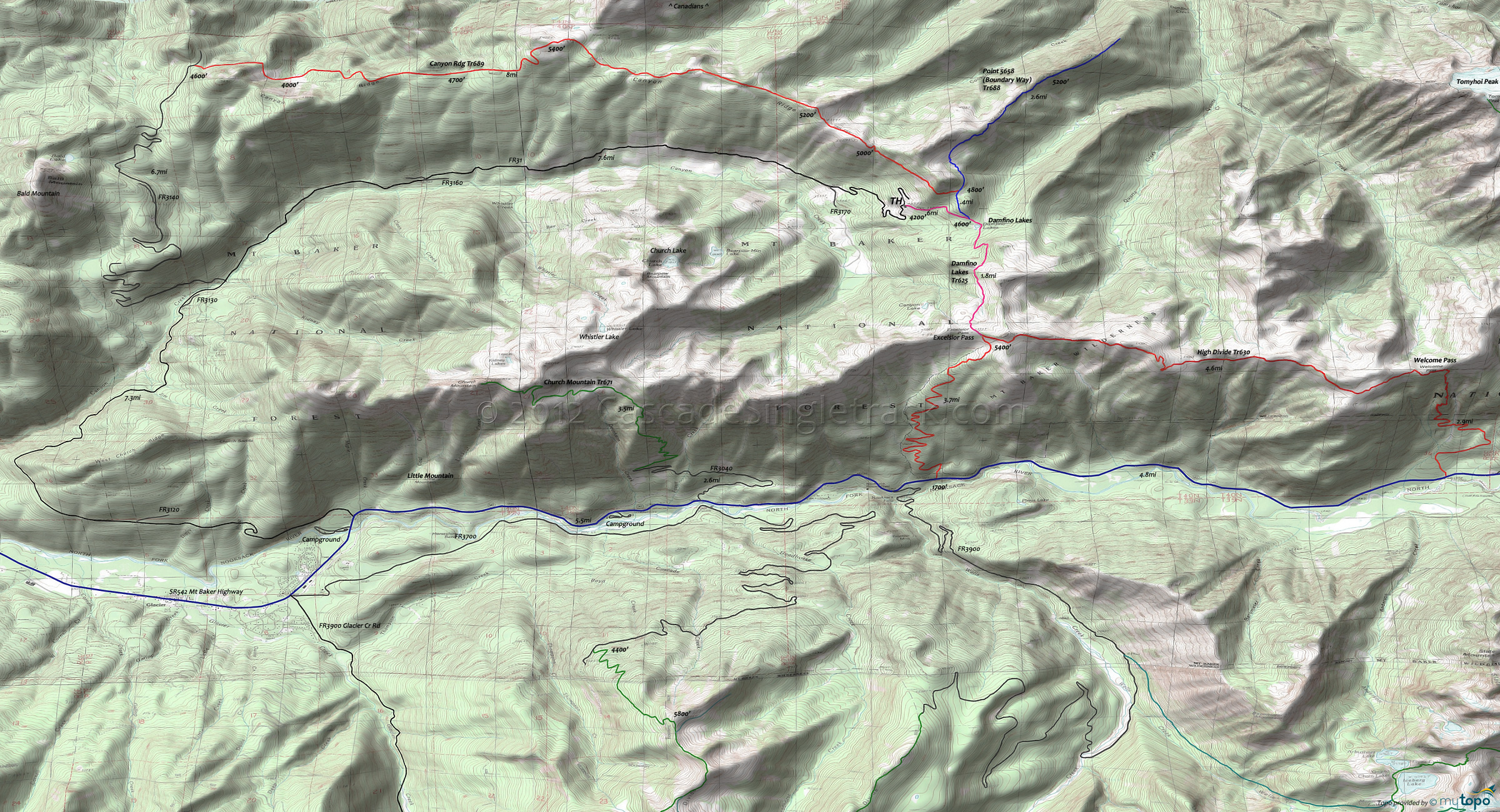
Canyon Ridge Trail 689 and Damfino Lakes Trail 625 Area Mountain Biking and Hiking Topo Map
Map includes: Canyon Ridge Trail 689, Damfino Lakes Trail 625, High Divide Trail 630, Point 5658 Boundary Way Trail 688 Mountain Biking and Hiking Trails.
route guide
TH: Ascend Damfino Lakes Tr625 at the clearcut, towards Damfino Lakes, with a steep ascent through mature forest.
.6mi: Go left onto Point 5658 (Boundary Way) Tr688.
1mi: Go left onto Canyon Ridge Tr689 as the ascent levels off into a rugged ridgeline ride. Climb steadily to the first of several ride summits, at 2.7mi, descend, then climb to the next peak at 3.8mi.
5mi: The trail appears to end in a small meadow. Go to the right following surveyor's tape and rock cairns.
5.2mi: At the ride summit, go through the meadow, following surveyor's tape and rock cairns. The ridgeline beyond this point is less defined, resulting in a steep descent to FR3140.
7.1mi: Continuing from this point adds 1000' of climbing and this area was heavily logged a few years ago and so may still not be rideable.
Draggable map: Map window adjusts to screen size and will respond to touch control. Use scrollbar for mouse control.
No Map? Browser settings and some browser extensions can prevent the maps from appearing. Please see Site Tech


