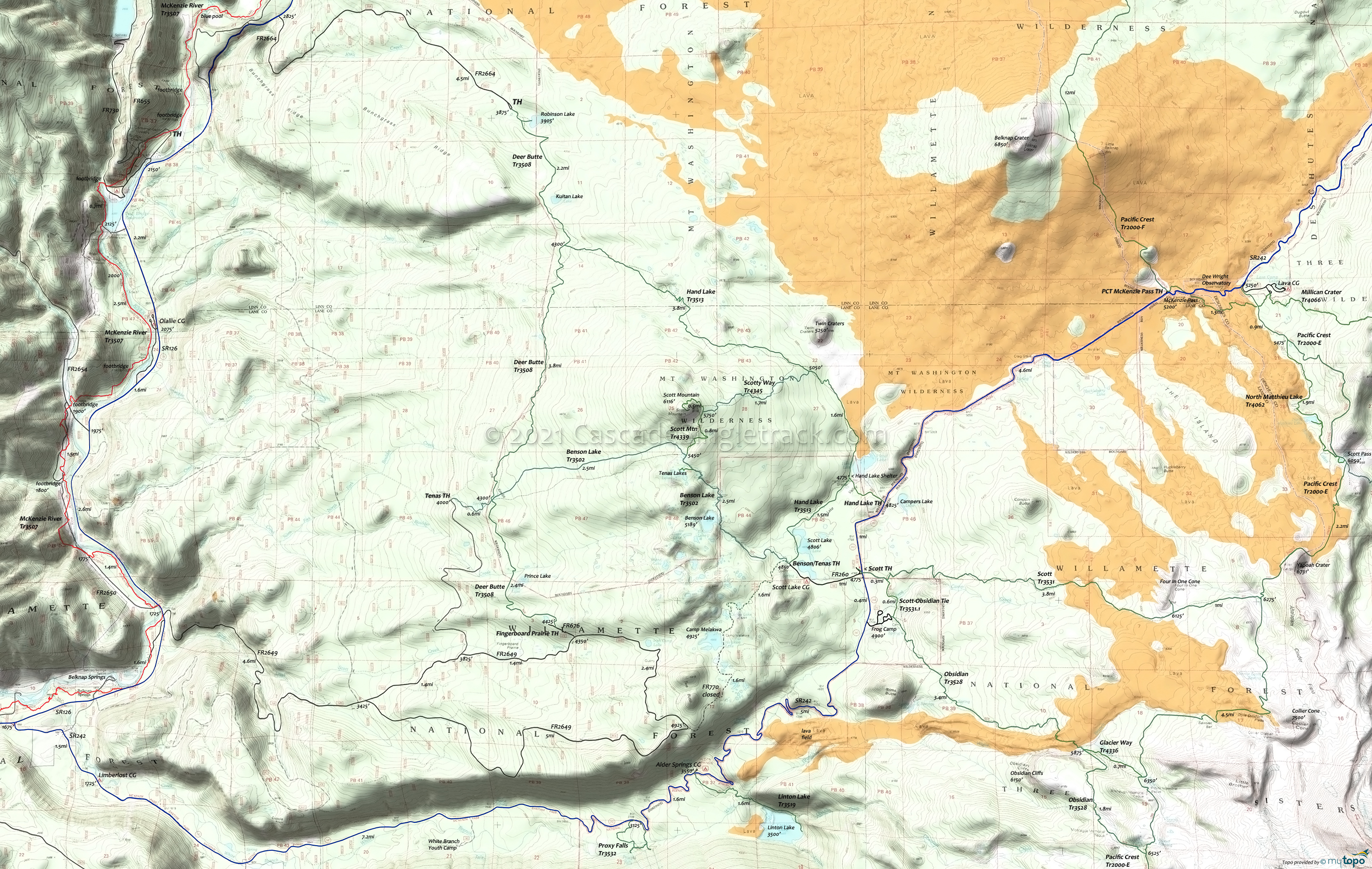
Mount Washington Wilderness Hiking Topo Map
Twitter Search
#PacificCrestTrail
Map includes: Benson Lake Trail 3502, Deer Butte Trail 3508, Glacier Way Trail 4336, Hand Lake Trail 3513, Hand Lake Cuttoff Trail 4344, Linton Lake Trail 3519, Millican Crater Trail 4066, North Matthieu Lake Trail 4062, Obsidian Trail 3528, Pacific Crest Trail 2000-E, Proxy Falls Trail 3532, Robinson Lake Trail 4342, Scott Trail 3531, Scott Mountain Trail 4339, Scott Obsidian Tie Trail 3531.1, Scotty Way Trail 4345, Tenas Lakes Trail 4340 Hiking Trails
Advance reservations of Limited Entry Area permits for the very popular Obsidian Limited Entry Area are ONLY available through the National Recreation Reservation System (NRRS) at recreation.gov or by calling 1-877-444-6777. Season starts May 1st.
Starting in 2021, the Mt. Jefferson, Mt. Washington, and Three Sisters Wilderness Areas will require a Central Cascades Wilderness Permit for Day or Overnight use, from May 28th to Sept 24th.
Scott Tr3531 passes through moderately forested areas, over lava flows and alpine meadows, to Pacific Crest Tr2000-E.
Deer Butte Tr3508 provides the western boundary of the popular Scott Mountain hiking system, passing through moderately forested, sub-alpine ecosystem, accessing Kuitan and Robinson Lakes.
Hand Lake Tr3513 and Benson Lake Tr3502 enable a variety of day hiking loops, with Scotty Way Tr4345 providing access to the Scott Mountain summit.
In the Three Sisters Wilderness Area, North Matthieu Lake Tr4062 is a segment of the Oregon Skyline Trail, replaced by the Pacific Crest Trail. Avaliable at the trailhead, Wilderness Permits are required for both day-use and overnight travel in the Wilderness from Memorial Day Weekend until Oct 31.
Draggable map: Map window adjusts to screen size and will respond to touch control. Use scrollbar for mouse control.
No Map? Browser settings and some browser extensions can prevent the maps from appearing. Please see Site Tech


