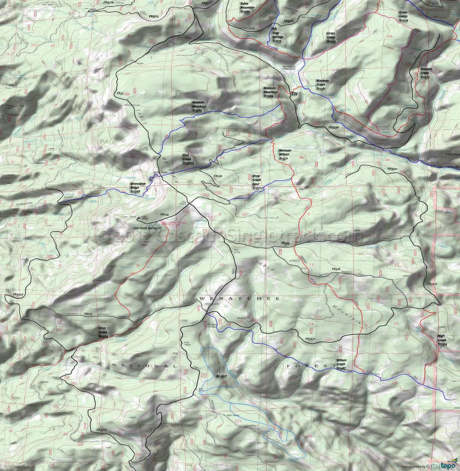
Table Mountain: Naneum Wilson Trail 1371 and Wilson Creek Trail 1387 Area Mountain Biking and Hiking Topo Map
Map includes: Drop Creek Spur Trail 1371.1, First Creek Jeep Trail 4W318, High Creek Trail 1354, Naneum Wilson Trail 1371, Naneum Meadows Trail 1389, Snowshoe Ridge Trail 1368 and Wilson Creek Trail 1387 Mountain Biking and Hiking Trails.
TH: Ascend the hillside on Naneum Meadows Tr1389, then traverse the hill to the .5mi Naneum Wilson Tr1371 intersection, continuing on Naneum Wilson Tr1371 in a steep descent to Owl Creek. Pass the Owl Creek Tr1371.2 intersection on the right at 1.3mi, then cross several creeks (bear left at the fork) and hike-a-bike out of the drainage.
2mi: Cross FR633, then cross the Drop Creek Spur Tr1371.1 4-way intersection, followed by a steep ascent to the Nealey Creek headwaters and FR315. Cross a stream at 2.6mi.
3.6mi: Cross FR315 then climb .5mi to the FR316 Ragan Way crossing meadow, the first ride summit. In a steep descent, follow the rock cairns while crossing FR113 at 4.4mi, FR240 at 5mi and FR3521 at 5.5mi.
6.2mi: Pass some sagebrush meadows then go right onto Wilson Creek Tr1387, slowly ascending along the southern edge of Table Mountain, through several minor Wilson Creek headwater drainages.
8.7mi: Go right onto FR35 and climb to the Naneum Meadows Tr1389 intersection, passing the FR315 intersection on the right at 10.2mi, the FR125 ride summit at 10.9mi, and passing the Owl Creek Tr1371.2 intersection at 11.5mi.
11.9mi: Go right onto Naneum Meadows Tr1389, which runs .7mi to the edge of the plateau then steeply switchbacks the Owl Creek drainage, crossing Owl Creek at 13.1mi and another tributary at 13.8mi.
14mi: Go left at the Naneum Wilson Tr1371 intersection and head back to the TH.
Draggable map: Map window adjusts to screen size and will respond to touch control. Use scrollbar for mouse control.
No Map? Browser settings and some browser extensions can prevent the maps from appearing. Please see Site Tech


