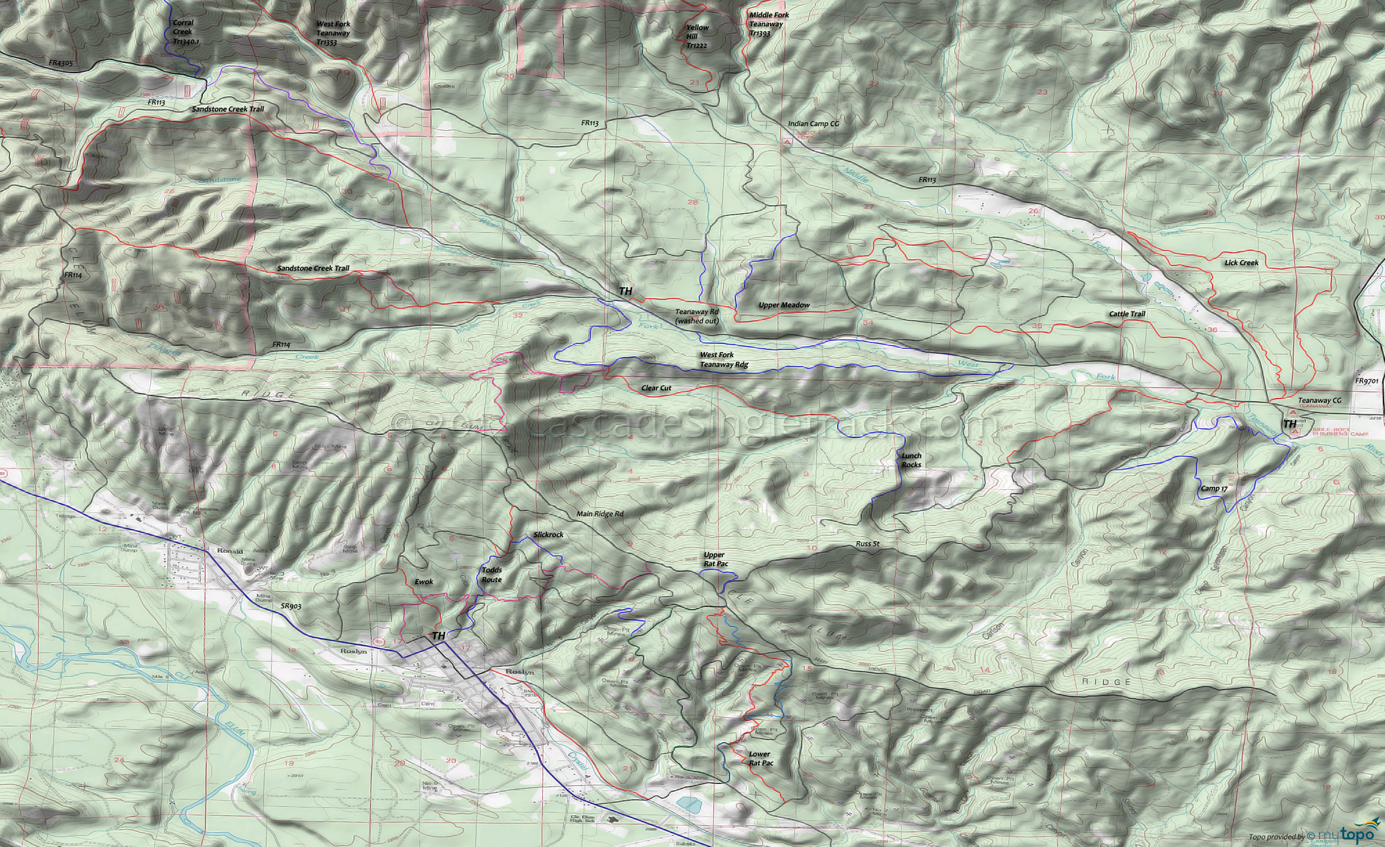
Sandstone Creek Trail and West Fork Teanaway Ridge Trail Area Mountain Biking and Hiking Topo Map
Map includes: Camp 17 Trail, Cattle Trail, Lick Creek Trail, Lunch Rocks Trail, Sandstone Creek Trail, Upper Meadow Trail, West Fork Teanaway Ridge Trail Mountain Biking and Hiking Trails.
TH: From the FR114 TH, ride .6mi to the 'sandstone creek' road and go left. Go right on the singletrack at 1.9mi and begin the ascent.
2.3mi: Although there are many singletrack trails headed in every direction, pass a singletrack on the right which runs alongside the West Fork Teanaway, to the Corral Creek Tr1340.1 TH.
3.6mi: The ascent levels out, then cross a small FR113 access road. At 4mi, just above FR113, begin the final (550') ridgeline ascent.
4.8mi: Go left on forest road and continue for .1mi, then go left on FR114. At the 5.3mi ride summit, go left onto the singletrack and begin the descent to the TH.
5.9mi: Trail drops off the ridgeline and the descent gets steeper and more rugged.
Draggable map: Map window adjusts to screen size and will respond to touch control. Use scrollbar for mouse control.
No Map? Browser settings and some browser extensions can prevent the maps from appearing. Please see Site Tech


