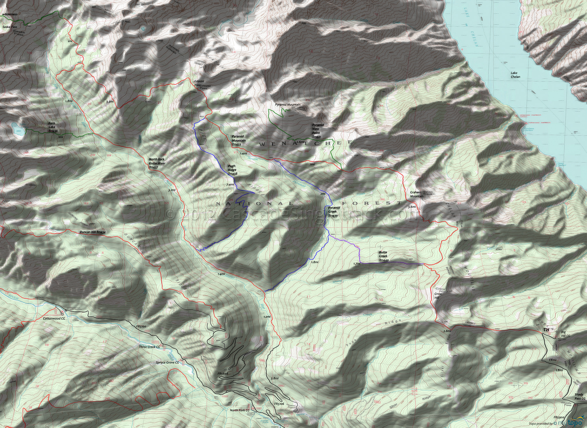
Pyramid Mountain Trail 1433 and Pyramid View Point Trail 1441 Area Mountain Biking and Hiking Topo Map
Map includes: Butte Creek Trail 1440, Fern Lake Trail 1436, North Fork Entiat River Trail 1437, Pugh Ridge Trail 1438, Pyramid Creek Trail 1439, Pyramid Mountain Trail 1433 and Pyramid View Point Trail 1441 Mountain Biking and Hiking Trails.
TH: From the Big Hill trailhead, ride FR112 to the Pyramid Mountain Tr1433 TH, near the sharp left curve. Slight .6mi descent, followed by a 500' ascent to Silver Ridge at 1.5mi. Ride 1mi along the ridge to Crow Hill, then navigate a switchback descent of 800' over the next 1mi to the Butte Creek headwaters, blazing past the Butte Cr Tr1440 intersection on the left at 2.9mi (bear right to stay on the trail).
3.5mi: From the Butte Creek headwaters, ascend 1.5mi and 950' to the Graham Mtn summit, with steep, rocky terrain giving way to a more moderate ascent. The trail then breaks away the ridgeline for the remainder of the ride.
6.5mi: Misery Option: Take a right on Pyramid View Pt Tr1441, which is mostly rideable for 1mi, before turning into a rocky hike-a-bike trek to the summit. Otherwise, descend 1100' over 1mi to Pyramid Creek Tr1439 intersection.
7.6mi: From the Pyramid Creek Tr1439 intersection, grind 1381' over the next 2mi to Grouse Pass, the toughest climb of this ride. The last .5mi will be hike-a-bike for most riders.
9.6mi: From Grouse Pass, descend 800' over 1mi, to just above the Grouse Creek headwaters, then traverse the side of the Cardinal Peak hillside. The last 2mi to the turnaround point is relatively flat, but uneven.
12.2mi: Pass the N. Fork Entiat Rvr Tr1437 intersection on the left and continue for 1mi (stopping short of the final ascent to Saska Pass), then return to the TH.
Draggable map: Map window adjusts to screen size and will respond to touch control. Use scrollbar for mouse control.
No Map? Browser settings and some browser extensions can prevent the maps from appearing. Please see Site Tech


