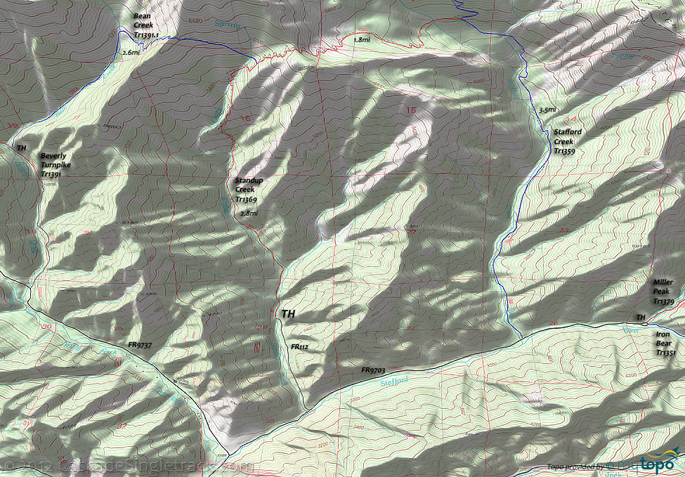
Bean Creek Trail 1391.1, Stafford Creek Tr1359 and Standup Creek Trail 1369 Mountain Biking and Hiking Topo Map
TH: Park along FR112 and descend to FR9703.
2.8mi: Go left on Stafford Creek Tr1359 and ascend the increasingly intense terrain to the Stafford Creek headwaters.
6.3mi: After a few switchbacks and a traverse, go left onto Standup Creek Tr1369. Cross Stafford Creek at 6.5mi, then ascend/hike-a-bike to the Earl Peak ridgeline saddle at 7.8mi. It's all downhill from here..
8.2mi: After a steep, switchback descent, including some hike-a-bike, pass the Bean Creek Tr1391.1 intersection on the right, then criss-cross Standup Creek and descend to a ridgeline.
8.9mi: The trail drops off the ridgeline in a .5mi switchbacking slide, before plunging across the creek. The descent then moderates and the trail crosses Standup Creek several more times before reaching the TH.
Draggable map: Map window adjusts to screen size and will respond to touch control. Use scrollbar for mouse control.
No Map? Browser settings and some browser extensions can prevent the maps from appearing. Please see Site Tech


