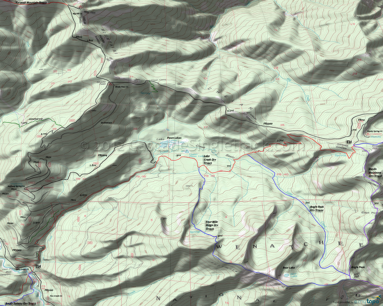
Angle Peak Trail 1444 and Lake Creek Trail 1443 Area Mountain Biking and Hiking Topo Map
Map includes: Angle Peak Trail 1444, Devils Backbone Trail 1448, Four Mile Ridge Trail 1445 and Lake Creek Trail 1443 Mountain Biking and Hiking Trails.
TH: Ascending from the Lake Creek campground TH, tackle .8mi of rough terrain through three switchbacks. Ascending the Lake Creek drainage, reach FR5900 at 1.45mi, near a curve in the road, then cross some doubletrack and parallel FR5900 until 2.7mi.
4.5mi: As the trail opens up into the Lake Creek basin, cross Lake Creek then cross FR5904, maybe wishing that had been the trailhead. Pass Upper Pawn Lake at 5.1mi.
5.5mi: Pass the Four Mile Ridge Orv Tr1445 intersection on the right, then cross several Lake Creek tributaries. Pass the Angle Peak Orv Tr1444 intersection on the right at 6.5mi and start the final switchback ascent to the Devils Backbone Orv Tr1448 TH.
9.2mi: Go right onto Devils Backbone Orv Tr1448 TH, with a brief climb leading to a rugged ridgeline, passing East Point on the way to the 3-ridged Angle Peak.
12.2mi: Pass the Angle Peak Orv Tr1444 intersection on the right then take Four Mile Ridge Orv Tr1445 and ascend 1.6mi to the Bear Lake overlook, then drop sharply off the ridge into a steep, switchback descent.
16.3mi: Go left onto Lake Creek Orv Tr1443 and return to the TH.
Draggable map: Map window adjusts to screen size and will respond to touch control. Use scrollbar for mouse control.
No Map? Browser settings and some browser extensions can prevent the maps from appearing. Please see Site Tech


