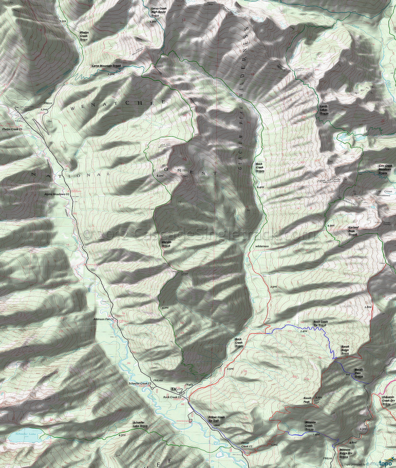
Old Gib Trail 1528 and Schaefer Lake Trail 1519 Area Hiking Topo Map
Map includes: Carne Mountain Trail 1508, Garland Peak Trail 1408, Old Gib Trail 1528, Rock Creek Trail 1509, Schaefer Lake Trail 1519 Hiking Trails.
Wilderness Hiking: Rock Creek ascends to the base of Carne Mountain, with several great hiking trails in the Glacier Peak Wilderness Area.
Old Gib Tr1528 offers a rugged ridgeline route, over Estes Butte and Old Gib Mountain, to Carne Mountain.
The hike can be extended with Leroy Creek High Route Tr1512 and FR6200 is well suited for shuttling.
FR6200 Camping: (listed from north to south) Phelps Creek CG, Alpine Meadows CG, Nineteenmile CG, Atkinson Flat CG, Schaefer Creek CG, Rock Creek CG, Riverbend CG, Huckleberry Ford CG, Grouse Creek CG, Meadow Creek CG.
Draggable map: Map window adjusts to screen size and will respond to touch control. Use scrollbar for mouse control.
No Map? Browser settings and some browser extensions can prevent the maps from appearing. Please see Site Tech


