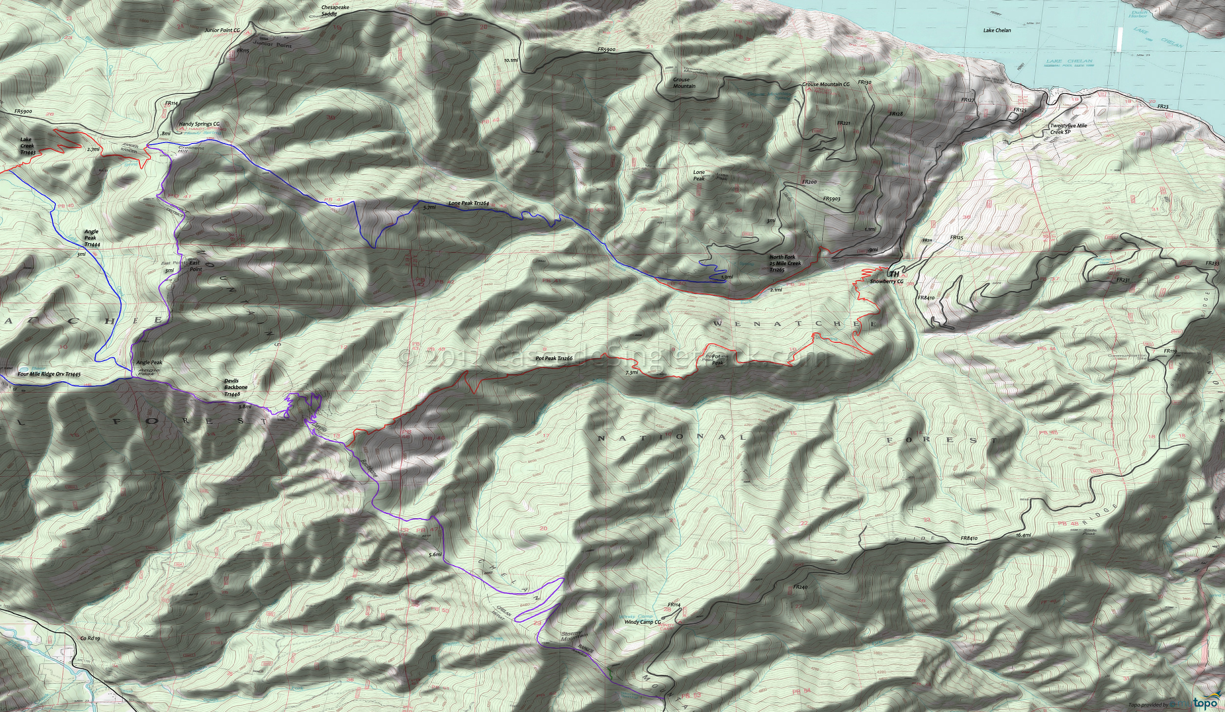
Pot Peak Trail 1266 Area Mountain Biking and Hiking Topo Map
Map includes: Devils Backbone Orv Trail 1448, Lone Peak Trail 1264, North Fork Twentyfive Mile Creek Trail 1265, Pot Peak Trail 1266 Mountain Biking and Hiking Trails.
TH: From the TH, go left on FR5900 and settle in for the long climb. Pass the 25 Mi. Cr. Tr1265 TH on the left at 1mi and FR5903 on the left at 2mi.
4.5mi: Pass the Grouse Mountain campground on the right, then circumnavigate the Grouse Mountain summit at 5.3mi. The ascent incline moderates at 9mi, descending to Chesapeake Saddle.
9.5mi: Climb from Chesapeake Saddle, past the Junior Point campground at 10.3mi, reaching FR114 at 11.2mi. Go left onto FR114, past the Handy Spring campground on the left, to the Devils Backbone Tr1448 TH. Ride or hike the first .2mi, to the 3-way intersection.
12mi: Go left at the 3-way intersection of Lake Creek Orv Tr1443, Devils Backbone Orv Tr1448 and Lone Peak Orv Tr1264, then left again at the next fork (just beyond the first fork). The ridgeline descent starts immediately and intensifies as the trail drops to the North Fork of Twentyfive Mile Creek, turning into switchbacks at 15.8mi for the last .7mi to the creekside portion of the ride.
16.6mi: Cross the creek then cross several side creeks before reaching the North Fork Twentyfive Mile Creek Orv Tr1265 intersection at 17.6mi. Go right and return to the TH.
Draggable map: Map window adjusts to screen size and will respond to touch control. Use scrollbar for mouse control.
No Map? Browser settings and some browser extensions can prevent the maps from appearing. Please see Site Tech


