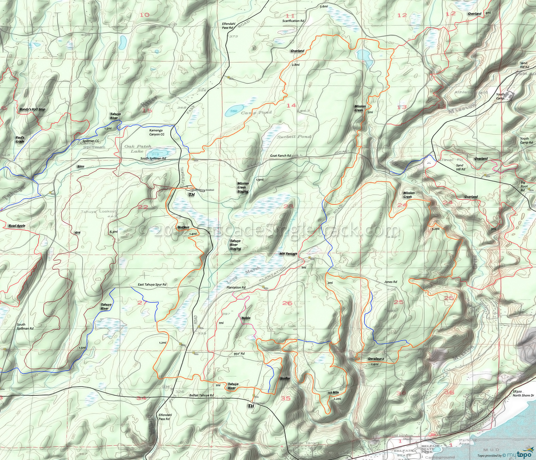
Tahuya State Forest: Mission Creek, 1.9 Mile, Deraileur-2, Overland, Nucleus, Tahuya River Mountain Biking and Hiking Topo Map
The 19mi (2100' ascent) Mission Creek, Overland CCW loop can be extended 6.5mi by riding the 10.5mi (1200' ascent) Overland eastern loop. Tahuya River Trail could also be added to this loop.
Note: Singletrack trails are marked in red on the Area Map. The green trails are wide doubletrack. Blue trails are often doubletrack, but frequently ridden.


Mission Creek, 1.9 Mile, Deraileur-2, Overland, Nucleus, Tahuya River CCW Loop Elevation Profile Map
Draggable map: Map window adjusts to screen size and will respond to touch control. Use scrollbar for mouse control.
No Map? Browser settings and some browser extensions can prevent the maps from appearing. Please see Site Tech


