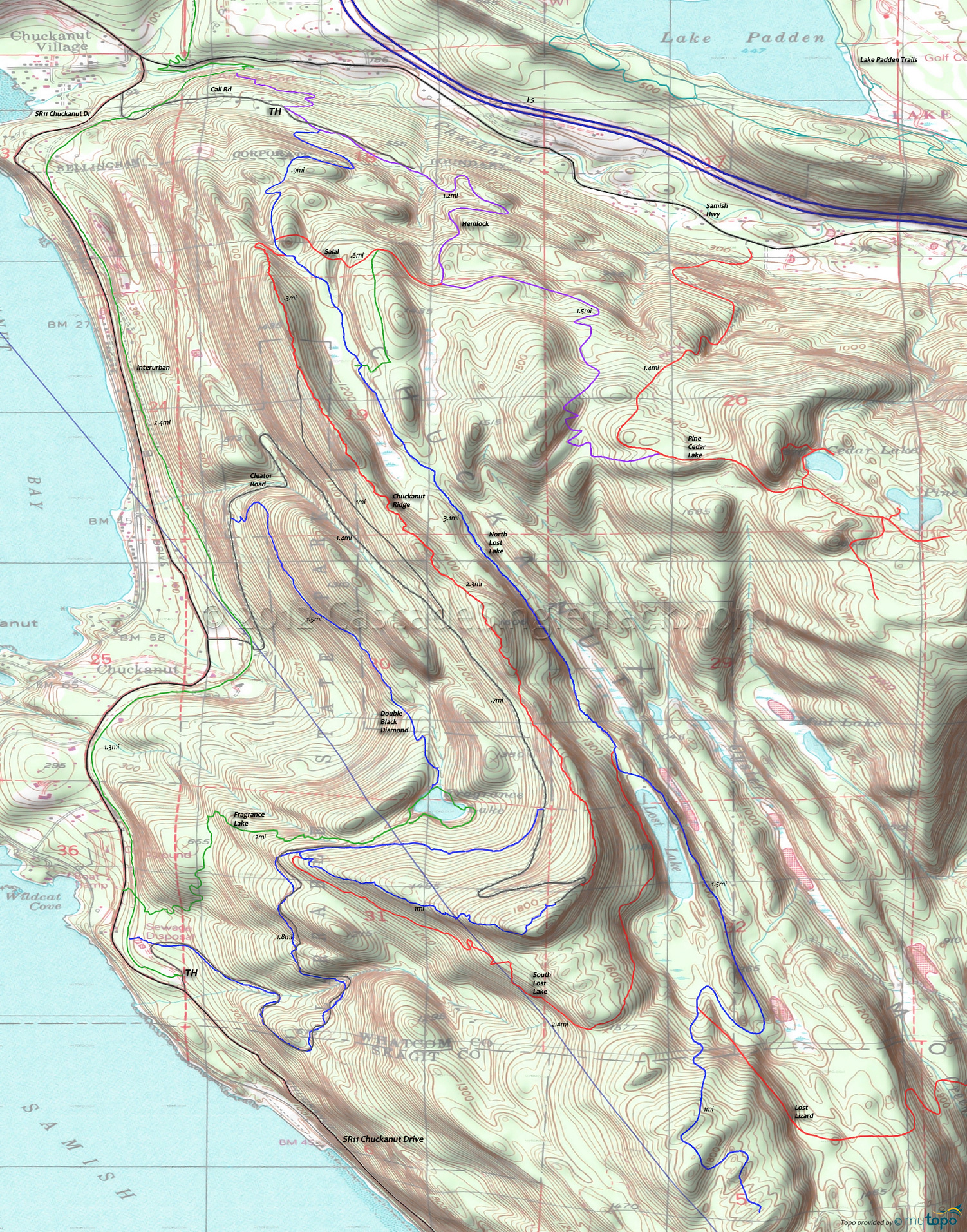
Chuckanut Ridge Trail Area Mountain Biking and Hiking Topo Map
Map includes: Chuckanut Ridge Trail, Double Black Diamond Trail, Fragrance Lake Trail, Hemlock Trail, Interurban Trail, Madrone Crest Trail, North Lost Lake Trail, Pine Cedar Lakes Trail, Salal Trail Mountain Biking and Hiking Trails.
TH: Ascend from Arroyo Park or California Rd, using Hemlock Tr to reach North Lost Lake Tr at .5mi.
1.6mi: After passing the Chuckanut Ridge/Salal Tr intersection at 1.4mi, reach the first plateau, then ride the ridgeline to South Lost Lake Tr.
3.7mi: Go right onto South Lost Lake Tr, ascending to the peak at 4.7mi then descending sharply to Double Black Diamond Tr at 5.9mi.
5.9mi: Go right then right again, to steeply ascend Double Black Diamond Tr to Cleator Rd.
7mi: At the sharp curve, go right onto Chuckanut Ridge Tr and descend to the Lost Lake Tr intersection.
9.8mi: Cross Lost Lake Tr and ride Salal Tr to Hemlock Tr.
10.4mi: Go left onto Hemlock Tr and ride back to Arroyo Park.
Draggable map: Map window adjusts to screen size and will respond to touch control. Use scrollbar for mouse control.
No Map? Browser settings and some browser extensions can prevent the maps from appearing. Please see Site Tech


