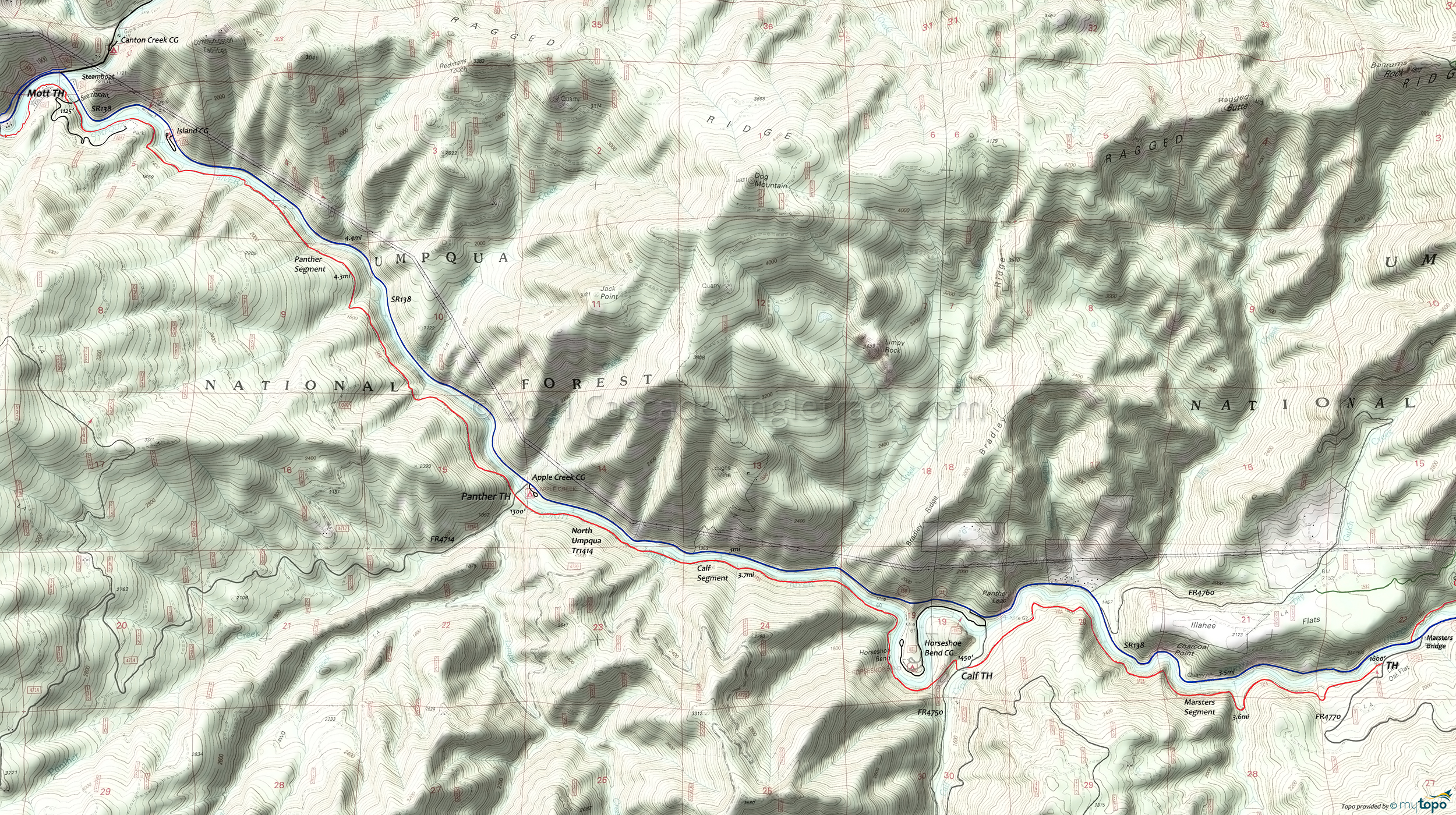
North Umpqua Trail: Panther to Marsters Mountain Biking and Hiking Topo Map
Twitter Search
#NorthUmpquaTrail
TH: Ride from the Mott bridge, passing a park connector trail on the right at .6mi, at the beginning of a steep .2mi drainage climb, then a creek crossing and descent to another creek crossing at 1.1mi. After yet another creek crossing at 1.5mi, ascend several hundred feet as the trail traverses the hillside above the river, then cross another creek at 2.7mi.
4.5mi: After riding through the giant Doug Fir stand, descend steeply to the FR4714 Panther TH and cross the road to pick up the trail again. This is the Calf segment, which is rough due to lack of use and may be closed due to periodic flood damage, a result of erosion caused by the 2002 fire.
8.2mi: After several creek crossings, and a ride around Horseshoe Bend, reach the FR4750 Calf TH, the start of the Marsters section. Marsters has some cliff exposure as it traverses up and down the hillside above the now-curvy North Umpqua River.
11.8mi: After crossing Deception Creek at 10.6mi, reach the Marsters TH, with an option to ride the Jessie Wright section. Be sure to leave enough energy and time to get back to Steamboat, although a bailout to SR138 and a coast downhill is possible if daylight is fading.
Draggable map: Map window adjusts to screen size and will respond to touch control. Use scrollbar for mouse control.
No Map? Browser settings and some browser extensions can prevent the maps from appearing. Please see Site Tech


