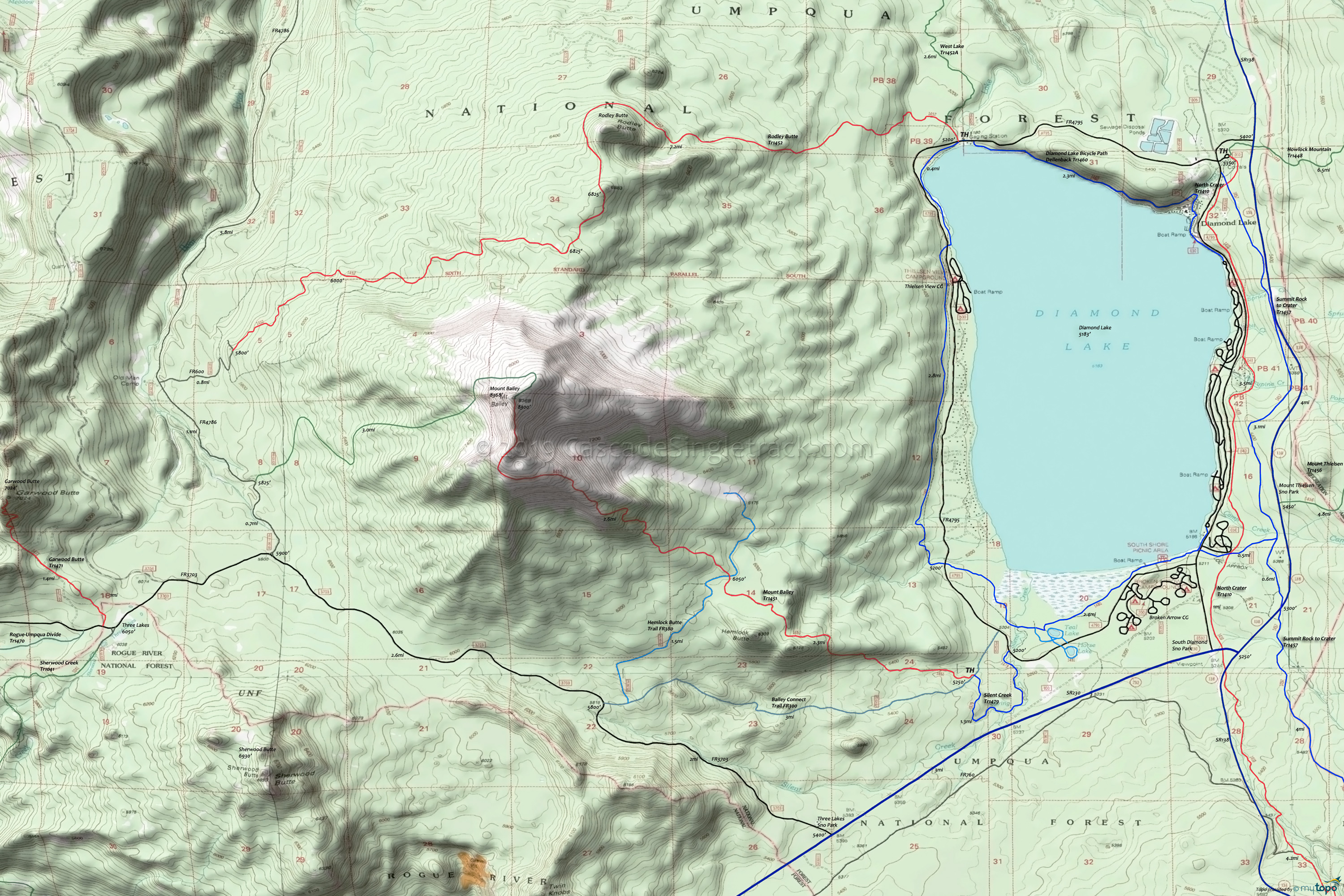
Diamond Lake to Mount Bailey Mountain Biking and Hiking Topo Map
Map includes: Mount Bailey Trail 1451, FR300 Bailey Connect Trail, Diamond Lake Dellenback Trail 1460, Garwood Butte Trail 1471, Hemlock Butte Trail FR380, Horse-N-Teal Trail 1481, Rodley Butte Trail 1452, Silent Creek Trail 1479 Mountain Biking and Hiking Trails.
TH: Gradual ascent through hemlock and fir to the slopes of Hemlock Butte, to the FR300 (Hemlock Butte trail) intersection.
2.3mi: Cross FR300 and ascend 1500' over the next 1.5mi to the timberline, after which the ascent becomes more gradual. The last mile is above the timberline, with increased view of the surrounding area.
4.9mi: Reach the rocky summit crater, then descend to FR300.
7.5mi: Option to go right on FR300, then left onto FR380 Bailey Connect Trail back to the TH.
Draggable map: Map window adjusts to screen size and will respond to touch control. Use scrollbar for mouse control.
No Map? Browser settings and some browser extensions can prevent the maps from appearing. Please see Site Tech


