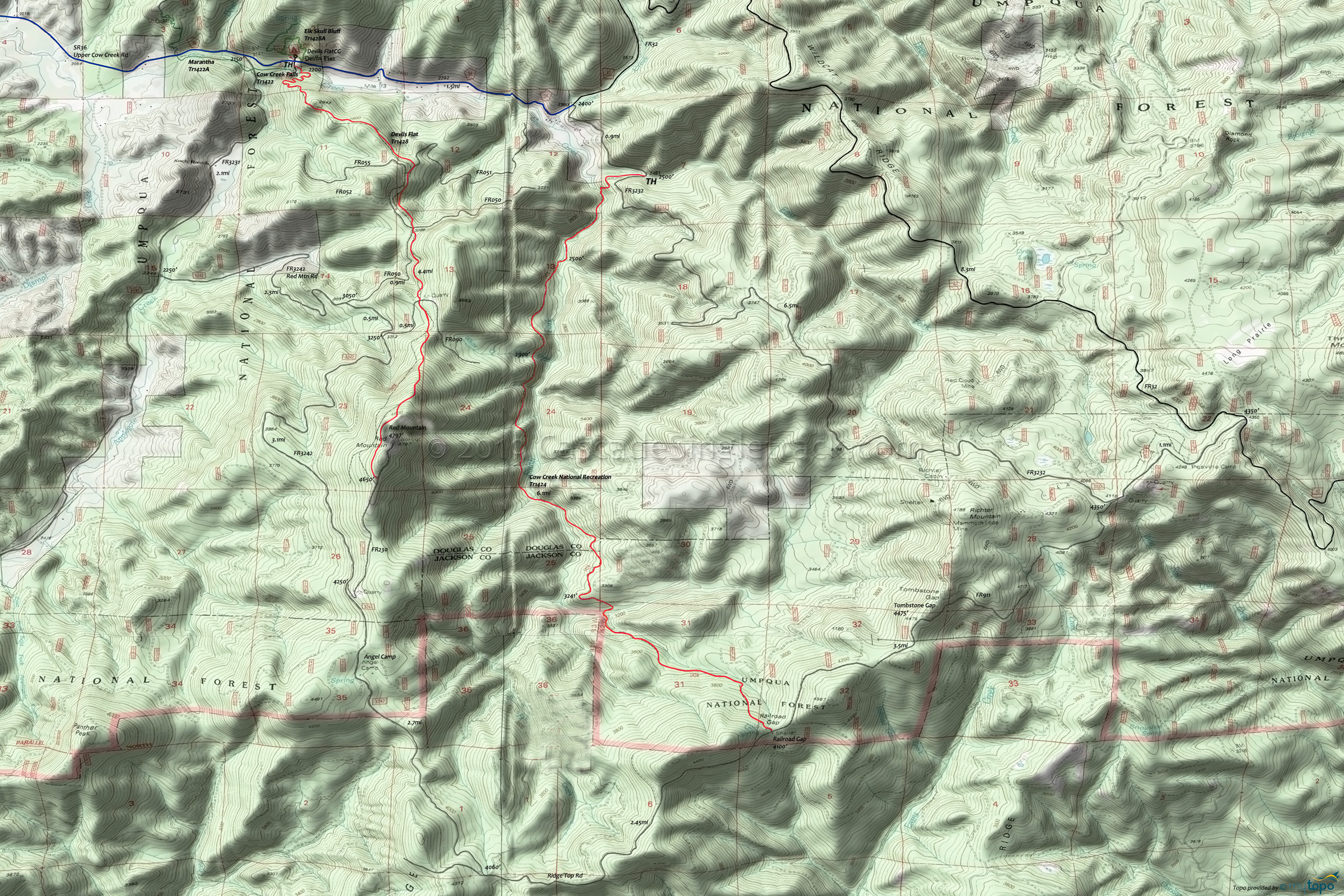
Devils Flat Trail 1428 Mountain Biking and Hiking Topo Map
Map includes: Cow Creek Falls Trail 1422, Cow Creek National Recreation Trail 1424, Devil's Flat Trail 1428, Elk Skull Bluff Trail 1428A, Maranatha Trail 1422A Mountain Biking and Hiking Trails.
TH: Ride from the Devils Flat Guard Station Day Use Area, through 0.5mi of switchback to the first knoll at 2800', continuing the ascent to FR051 crossing.
1.7mi: Cross FR051 and parallel FR055 to the FR050 intersection.
2.2mi: Cross FR050 and traverse the hillside just below FR050 to a quarry and FR090 crossing.
2.9mi: Cross FR090 and begin the steep 1.5mi ascent to the summit, with a traverse near the end of the climb.
4.4mi: Reach FR230. Go left on the road for 0.2mi to reach the former lookout, then return.
Draggable map: Map window adjusts to screen size and will respond to touch control. Use scrollbar for mouse control.
No Map? Browser settings and some browser extensions can prevent the maps from appearing. Please see Site Tech


